Use pull down menus above to navigate the site.
|
|
Maps of Gildersome

1577 Map by Christopher Saxton (a portion) Morley is below Ledes. Farnley Wood is shown above Morley and Gildersome would have been to the left of Morley and below Farnley Wood. I took the following from the Leodis Photographic Archive "Saxton was brought up at Dunningley in West Ardsley. He was educated at Cambridge University and then served as an apprentice map-maker to John Rudd, the vicar of Dewsbury, around 1570. Saxton is famous for making the first national atlas and his great achievement was noted by Queen Elizabeth I. She gave him the rights to publish his maps in his own name in 1577 to avoid plagiarism. Saxton has since been described as ‘the father of English cartography’."
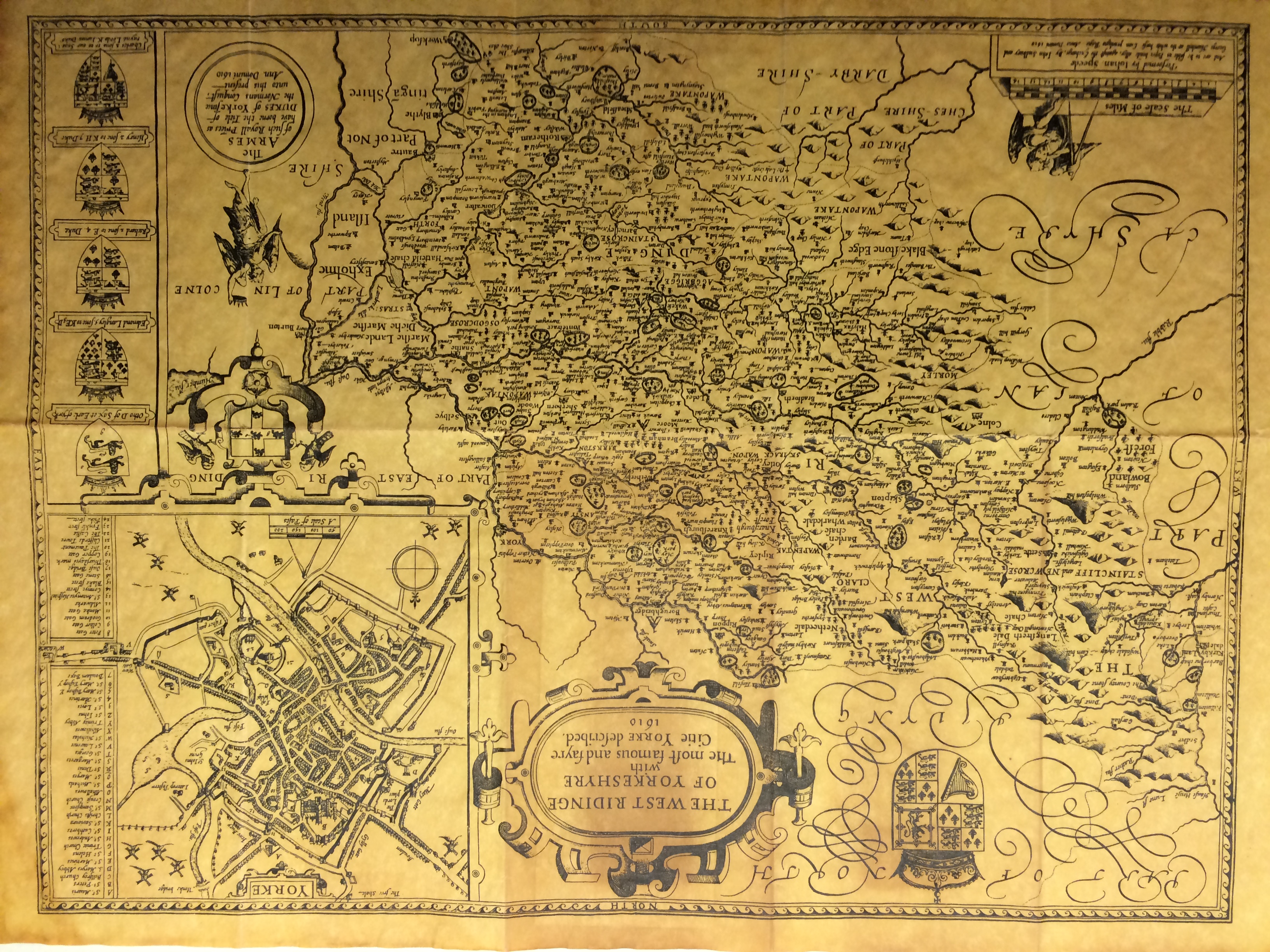
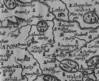
From "The West Ridinge of Yorkeshyre with The most famous and fayre Citie of Yorke described 1610" :
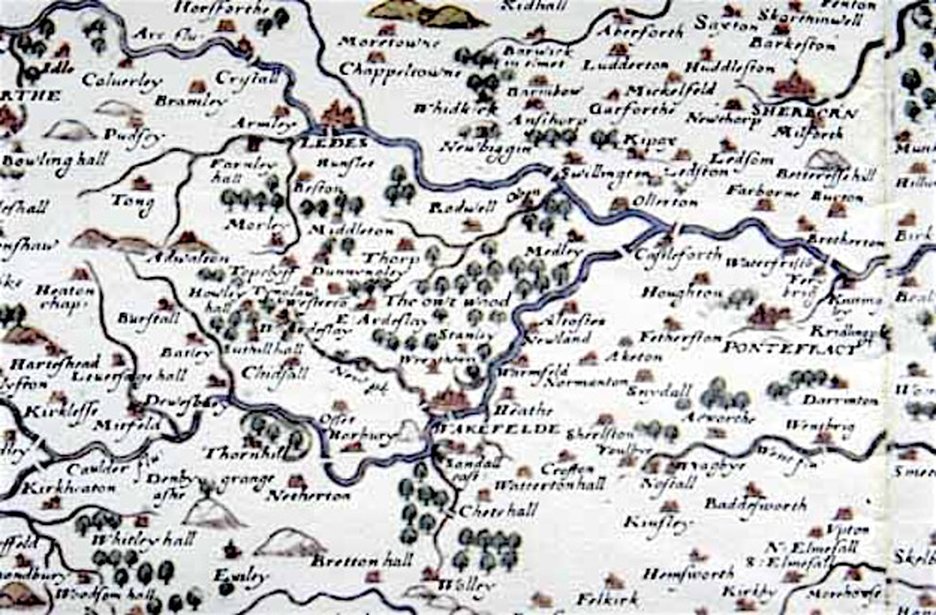
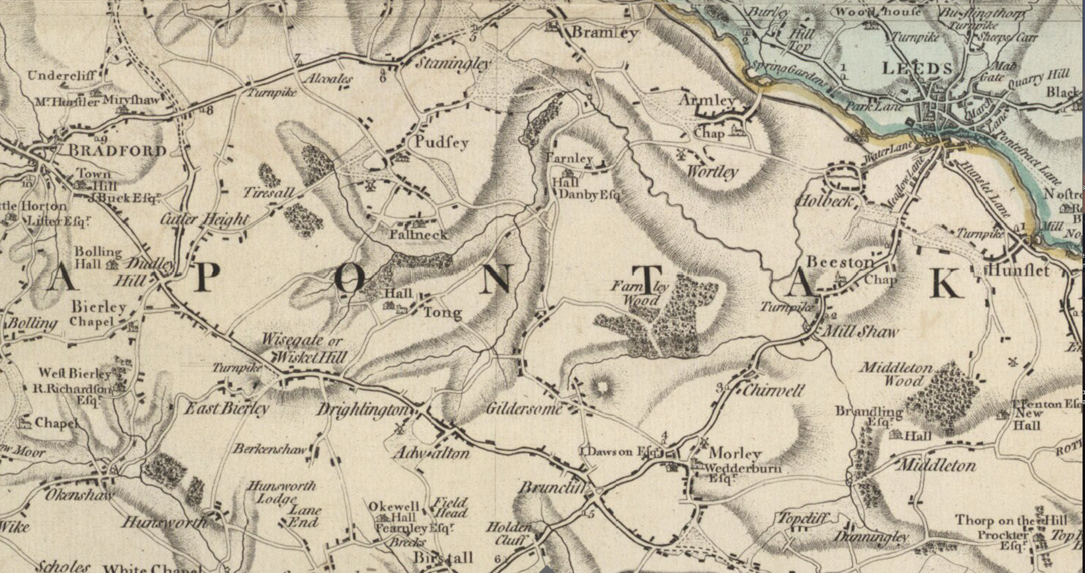
In this portion of the map of Yorkshyre, the Gildersome area is almost dead centre in the middle of the map. Gildersome, of little consequence, is not shown. Adwalton and Morley, each having a church, are depicted and Bruntcliffe (an important crossroad) is present even though it's of lesser size.
From a parchment reproduction that I own. Click on map to see the full version.

Circa 1700. The road from "Manchester to Derby". "Gilderson" is at the bottom of the third panel from the left. Interesting is that the "Quaker's Sepulture" in Bruntcliffe was added to the map. From a reproduction that I own.
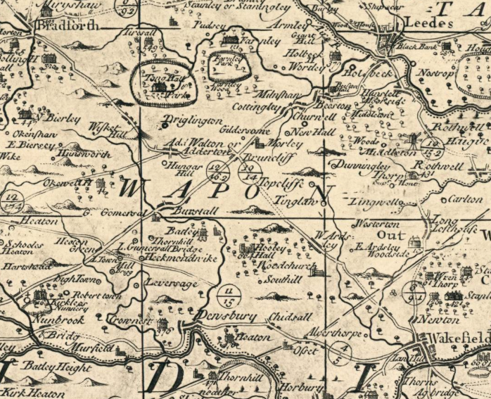
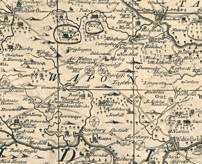
1720 Warburton's Map - A hundred and twenty years after the first map above, Gildersome is important enough to be shown by a simple dot. Map Courtesy of romanroads.org
|
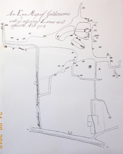
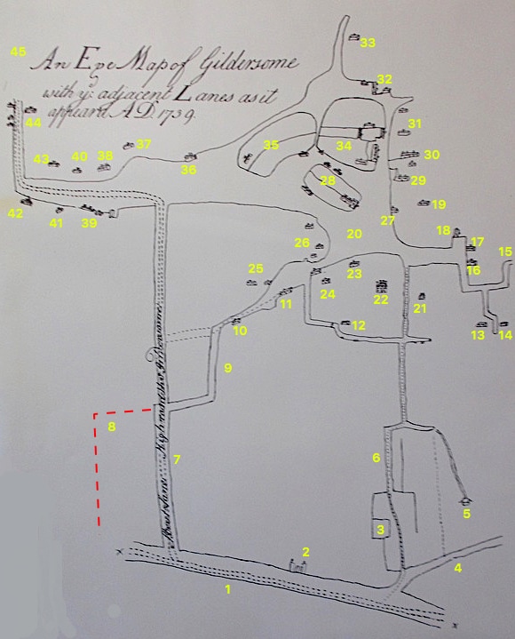
Gildersome 1739
Made about 20 years after Warburton's map above. Though lacking place and street names this map is fairly accurate and shows the concentration of buildings around The Green (#20). 
Click on the map above to see the original.
|
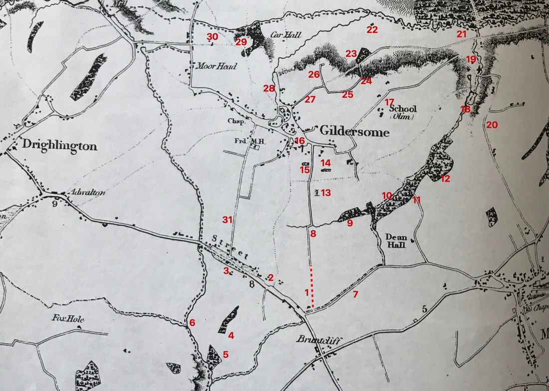
"An Eye Map of Gildersome with ye adjacent Lanes as it appeared A.D. 1739," attributed to Joseph Dickinson, a well known surveyor and mapmaker. Dickinson lived at Gildersome in a house adjacent to the Green across Town St. from today's Bownass' shop. When he wasn't mapmaking, he was an active member and benefactor to the Gildersome Quakers. It was drawn in the last year of his life and was probably commissioned as a survey map showing the location of the new highroad from The Street to Farnley, later to become Street Ln, Church St and Gildersome Ln. The open area on the map where today's streets run, was called the "waste" and animals of the less fortunate were free to graze there. At that time, The Street had several farms which were not depicted on the map.
Below is a list of places, most of which can be identified. If you can help with omissions or corrections please get in touch through the contact information at the bottom of the page. Maps courtesy of WYAS .
Below is a list of places, most of which can be identified. If you can help with omissions or corrections please get in touch through the contact information at the bottom of the page. Maps courtesy of WYAS .
|
1. The Street (Wakefield/Bradford Rd)
2. Toll Gate 3. Stone Pitts? 4. Nipshaw Lane 5. Mine or Colliery 6. Stone Pitts Lane (Old entrance to Gildersome) 7. The writing says: "Streets Lane Highroad thru Gildersome". 8. Possible early Finkle Lane entrance. 9. Finkle Ln. before shortcut, dashed lines above. 10. Park Farm 11. Park House & Nook 12. Old Quaker Meeting House 13. Halstead House (Old John Smith's House) 14. Ebenezer Hill House? 15. Collock Road to Philadelphia 16. Megget Farm 17. Highfield Farm 18. Old Inn 19. Harthill House 20. Location of The Green & large Thorn Tree 21. Old Hall 22. New Hall (Turton Hall)? |
23. Joseph Dickinson's House
24. ? 25. Cana House (Nathaniel Booth's) 26. Croft House (Location of today's Library) 27. Entrance to Harthill House 28. Sharp's House & Farm 29. Town End House 30. Town End House 31. Town End House 32. Manor House. Leeds Road & Bottoms 33. Stoney Gate & Lepton House 34. Reyner's Fold 35. Roger Croft 36. Scatcherd's Farm (Joshua Greathead's) 37. Booth House (pre Moorfield House) 38. Baptist Church 39. Booth Farm? 40. Baptist Manse? 41. ? 42. Scott Farm 43. ? 44. Royal Oak 45. To Farnley |
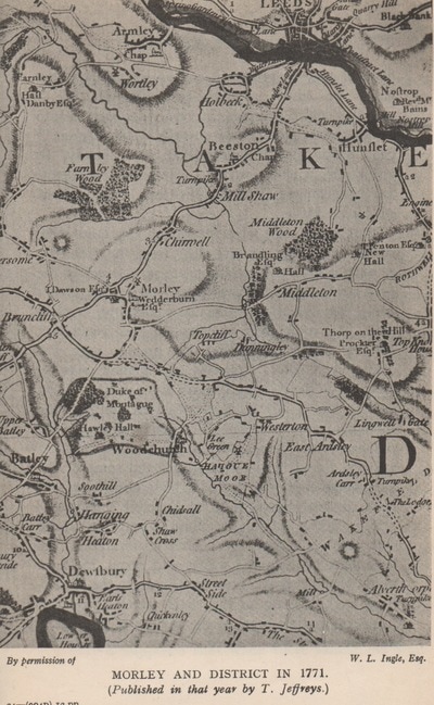
Gildersome 1771 It's interesting to note that Gildersome has two entrances, one from Morley Hole across Dean Beck and the other thru Old Coal Pit Rd via Nepshaw Lane.
Map by Thomas Jeffreys
Map by Thomas Jeffreys

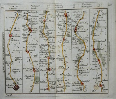
1782 Bowle's Post-Chaise Companion Gildersome is at the bottom, third column from the left.
Click here to see the Title Page From a page that I own.
Click here to see the Title Page From a page that I own.
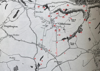
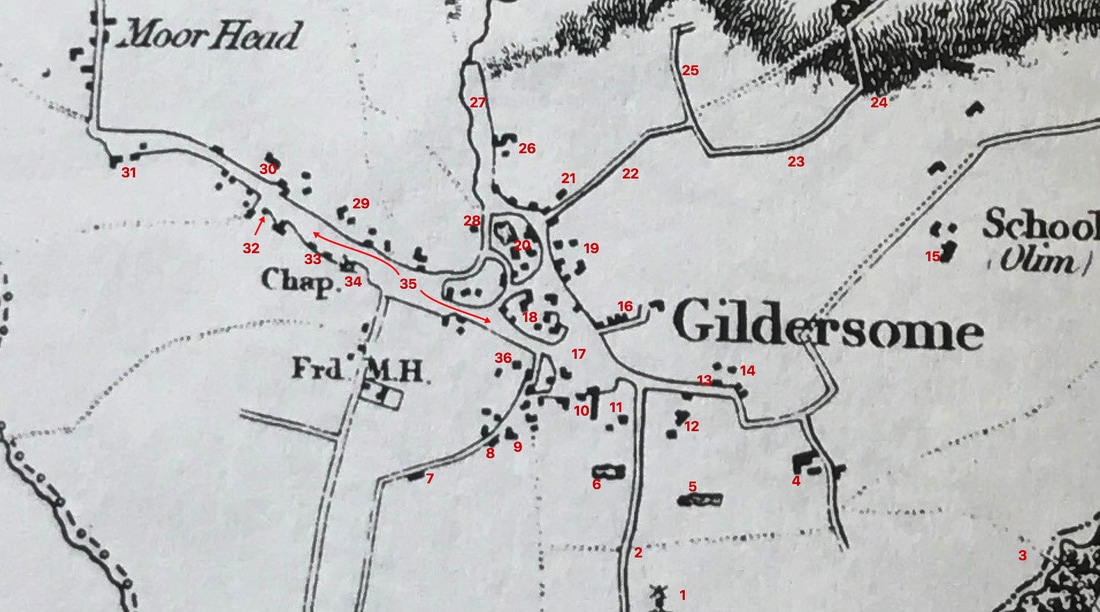
Gildersome and vicinity circa 1820s - With features that appear in the 1800 and 1824 Survey Maps. The fields and buildings in those two maps are numbered but unfortunately the key to both are missing. See map below.
Map courtesy of the Gildersome Library
Map courtesy of the Gildersome Library
|
1. Extension of Reidley Ln.
2. Pond above Street Langley Ln. Below. 3. Toll Bar 4. Egland Hill 5. Tingle Wood 6. Gamble Royd Beck 7. Nipshaw Lane 8. Reidley Ln. 9. Lumb Bottom 10. Dean Wood |
11. Dean Bridge
12. Clubbed Oaks 13. Windmill 14 Dam and Pond 15. Fish Pond 16. Green with Thorn Tree 17. Quaker School 18. Large Dam and Pond 19. Scribling Mill with Pond and Quarry. 20. To Morley |
21. Rooms Bridge, to Leeds
22. Nova Scotia, the Vicarage 23. Leathley Wood 24. Quarry 25. Mad Dog Lane 26. Boggard Lane 27. Hart Hill Lane 28. Stoney Gate (waste) 29. Major Spring Wood 30. Royal Oak 31. Street Lane |
The Circa 1820s Map Zoomed In.
|
1. Windmill
2. Reidley Lane 3. Dean Bridge 4. Old Hall 5. Dam & Pond 6. Fish Pond 7. Fore Door House 8. Park House 9. Hudson's Nook 10. Hall Fold 11. Turton Hall 12 Scribling Mill |
13. Griffin Inn
14. High Field Farm 15. Quaker School 16. Harthill House & Blacksmiths 17. Green with Thorn Tree 18. Sharp's House & Mill 19. Croft Farm 20. Armitage Mill 21. Manor House & Pinfold 22. Hart Hill Ln. 23. Mad Dog Ln. 24. Quarry |
25. Boggard Ln.
26. Lepton Place 27. Stoney Gate 28. Wood Well 29. Springfield Farm 30. Baptist Church 31. Scott Green 32. School 33. Spring View & Rock House 34. St Peter's 35. Lord's Waste 36. Grove House |

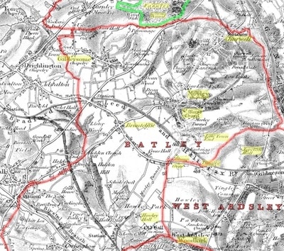
Batley Parish circa 1860s Source Unknown
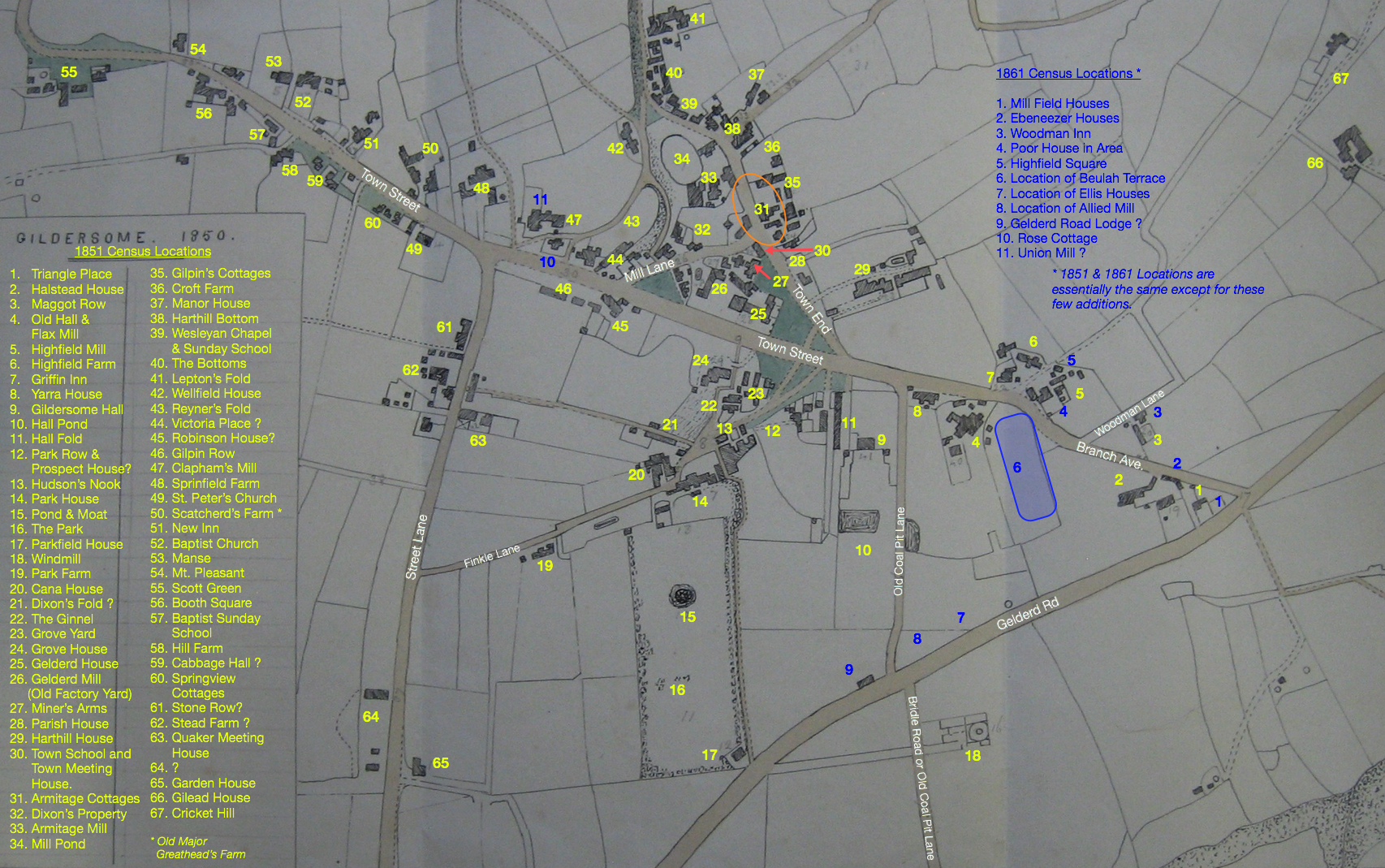
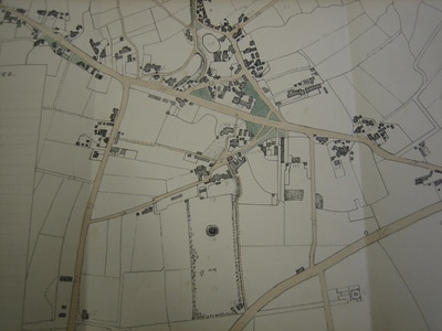
Gildersome circa 1850 This map was made by Alfred Bilbrough (1819 - 1891), who was born in Harthill House and eventually became its owner. Alfred was an accomplished artist and it appears he copied this map from either the Ordnance Survey or the Tithe Map. I added the place names and the numbers, many of which can be found in the 1851 and 1861 Census for Gildersome. Click to Enlarge
Map courtesy of the "Bilbrough/ Town Collection" WYAS Leeds.
Map courtesy of the "Bilbrough/ Town Collection" WYAS Leeds.
|
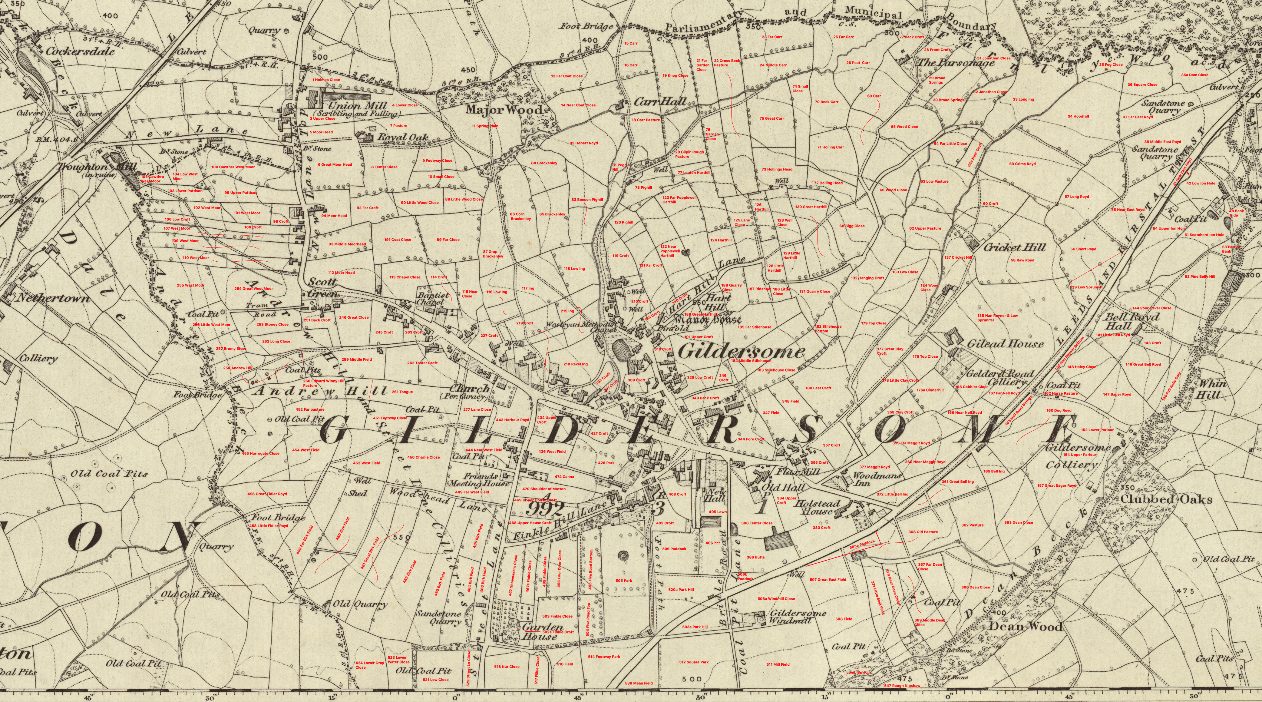
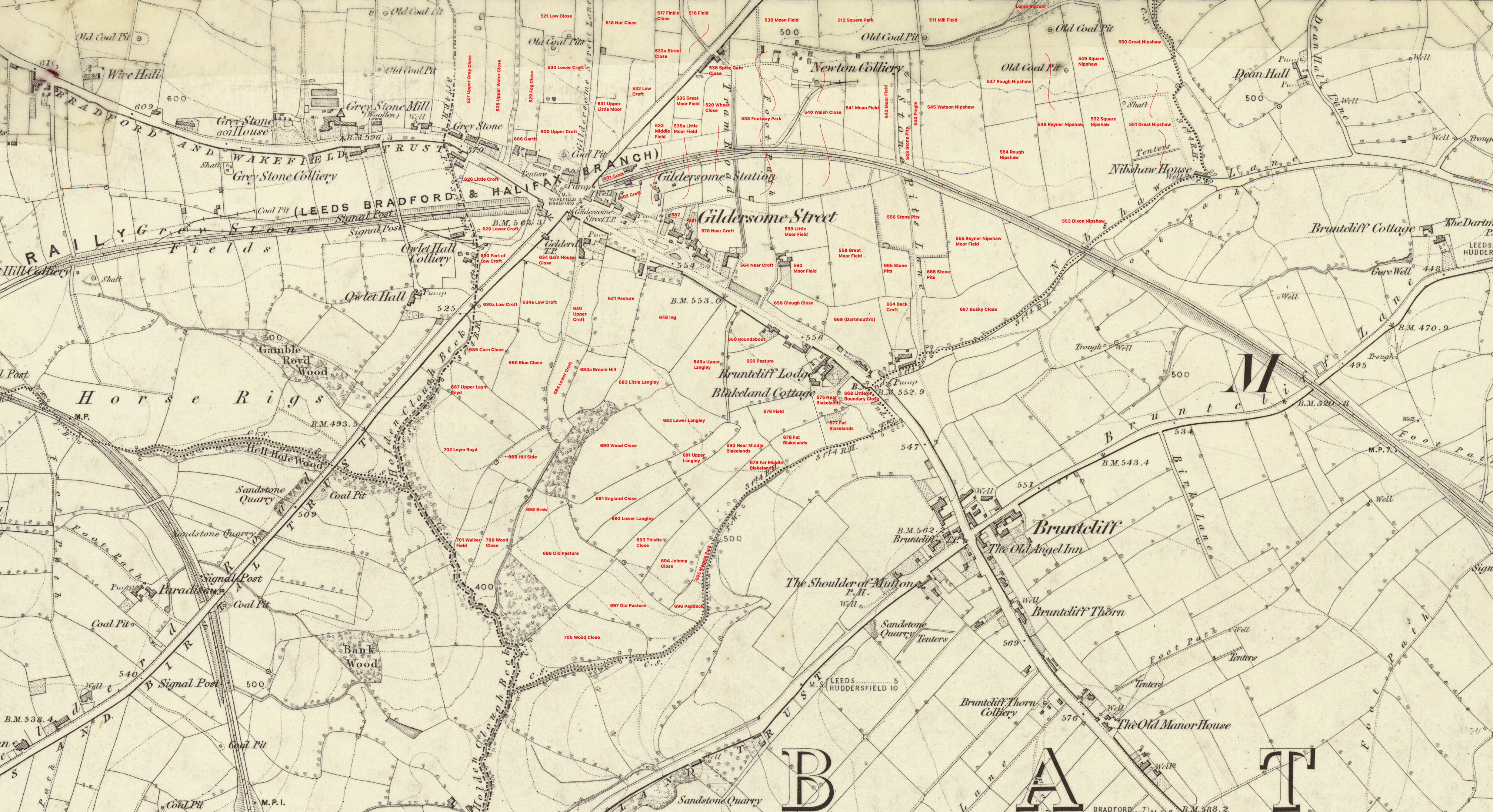
Gildersome 1852 Ordnance Map & 1836-1851 Tithe Information - The names and numbers of the fields have been added to this version.
Click on map above to view a larger version. Click on the small map, right, to see the key to the owners, occupiers and other tithe map information. Info provided b y Leeds Tracks in Time. |
|
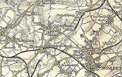
1908
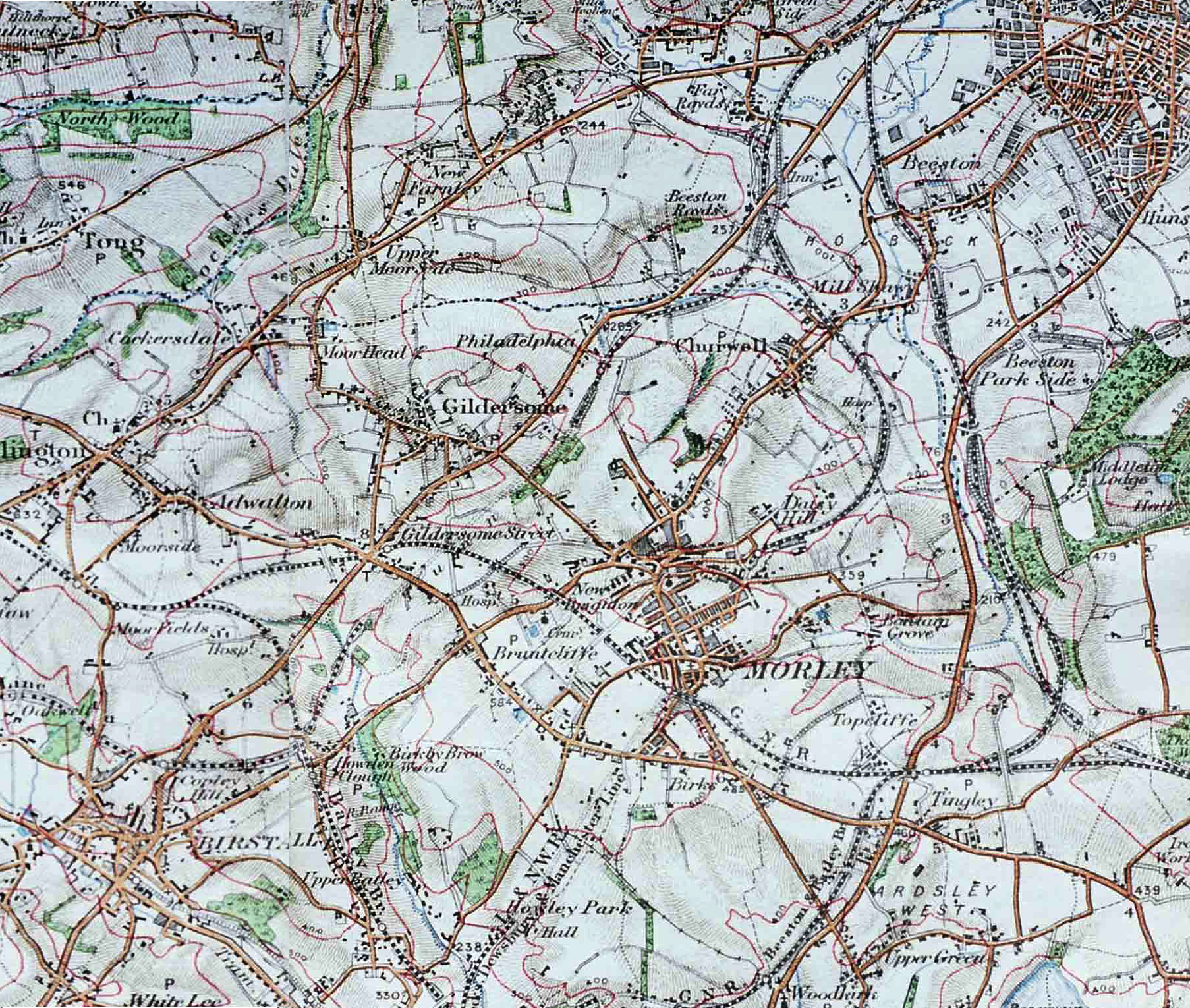
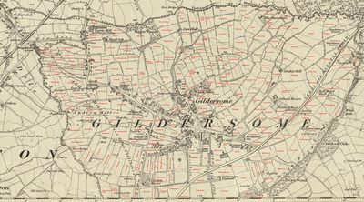
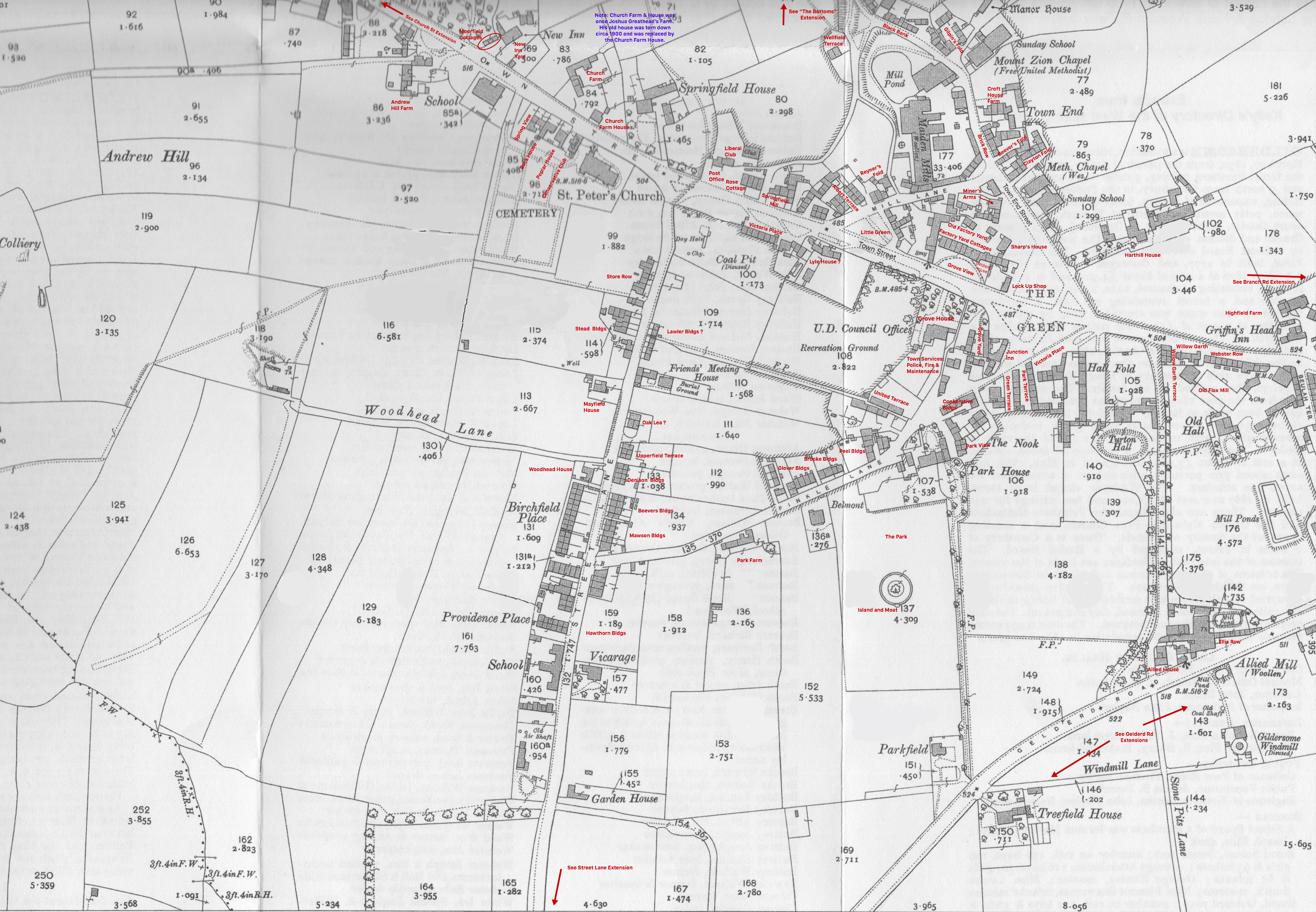
The General Gildersome Area Circa 1913
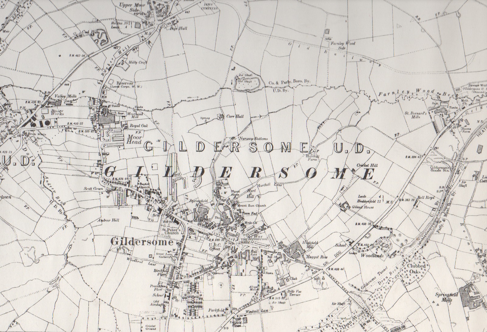
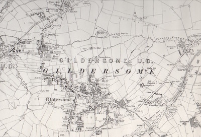
1937 Ordnance Survey from a map that I own.