Use pull down menus above to navigate the site.
** NOTE** To see other areas of Gildersome, use the thumbnails below to open the pages.
Branch End and Town Street (starting at the New Bridge to Street Lane)
Branch End:
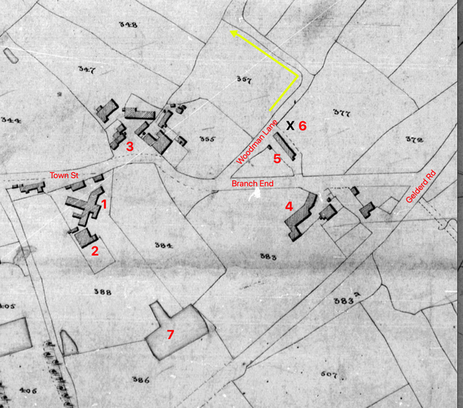
Before the year 1800, the sparsely populated area east of The Green could have been known as Town End but instead it was called Branch End. Perhaps it was called such because the lane forked (or branched) at the Griffin. The northern branch ran past Gilead House then to Philadelphia, eventually pressing on to Leeds. The southern branch skirted Mrs. Halstead's farm, then led on to Morley through Dean Wood utilising a bridge to cross Dean Beck. By 1800, the Leeds branch had become more of a local lane. To accommodate property changes to fields 355 and 357 (see map below) the entrance to the Leeds road was moved east. The new route became known as Woodman Lane, a portion of which still exists, now called Hawthorne View. Today, the Leeds branch has reconnected with the Griffin and is now known as Hawthorne Close only now the lane terminates at Cricket Hill. Of interest is the fact that this old Leeds branch was one of the first proposed routes for Gelderd Road (1814). (1)
Before the year 1800, the sparsely populated area east of The Green could have been known as Town End but instead it was called Branch End. Perhaps it was called such because the lane forked (or branched) at the Griffin. The northern branch ran past Gilead House then to Philadelphia, eventually pressing on to Leeds. The southern branch skirted Mrs. Halstead's farm, then led on to Morley through Dean Wood utilising a bridge to cross Dean Beck. By 1800, the Leeds branch had become more of a local lane. To accommodate property changes to fields 355 and 357 (see map below) the entrance to the Leeds road was moved east. The new route became known as Woodman Lane, a portion of which still exists, now called Hawthorne View. Today, the Leeds branch has reconnected with the Griffin and is now known as Hawthorne Close only now the lane terminates at Cricket Hill. Of interest is the fact that this old Leeds branch was one of the first proposed routes for Gelderd Road (1814). (1)
|
Left is from the circa 1843 Tithe Map (pre-railway) showing the east end of town. It differs little from the 1800 map with the exceptions of Maggot Row and Gelderd Road:
|
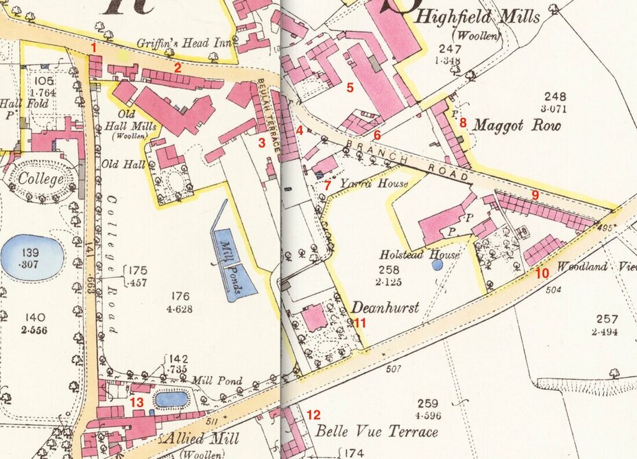
Branch End in 1890:
|
This map, stitched together from 2 sheets of the OS Map, shows the changes which took place after 1858. Many people who were living in Gildersome during the 1940s, 50s and 60s may still recall many of the features. The numbered items mark places which were put in sometime after 1858, though most were built in the 1860s:
|
1. Willow Garth
2. Webster Row 3. Beulah Terrace 4. Highfield Terr. 5. Expanded Mill Facilities 6. Highfield Cottages 7. Yarra House |
8. Maggot Row extended and
Woodman Inn gone. 9. Ebenezer Row 10. Woodland View 11. Dean Hurst 12. Belle View Terrace 13. Allied Mill, Ellis Row |
The Dean Bridge:
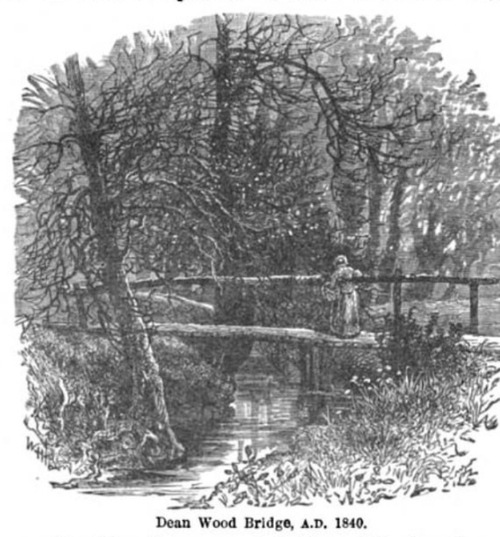
A footbridge across Dean Wood is clearly marked on the 1800 Enclosure Map of Gildersome as being slightly north of the present day Asquith Avenue bridge. Earlier maps also indicated a connection from Gildersome to Morley along a similar path suggesting that the route had once been a highroad to Farnley Moor. The construction of the Leeds and Birstall Turnpike (Gelderd Road) opened a quick road to Leeds (1825), and serious travel along the old lane and bridge slackened to a trickle of miners and mill workers going to and from their jobs. It took nearly 70 years and the building of the "New Bridge" to reconnect the two towns.
In the illustration above the bridge is little more than a log with a rough handrail on one side. The beck itself fell just within the Township of Morley, therefore Morley controlled the bridge and was responsible for its existence as well as its size and maintenance. It's evident, that in 1840, Morley did little to encourage traffic along this route.
In the illustration above the bridge is little more than a log with a rough handrail on one side. The beck itself fell just within the Township of Morley, therefore Morley controlled the bridge and was responsible for its existence as well as its size and maintenance. It's evident, that in 1840, Morley did little to encourage traffic along this route.
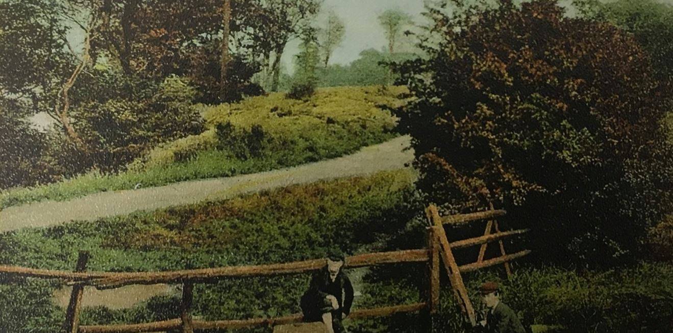
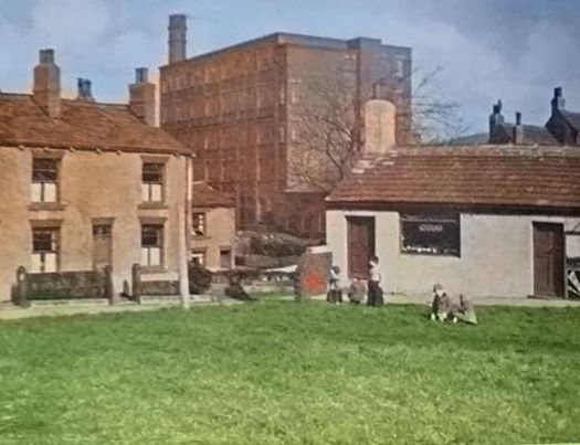
Perhaps a colourised version of a late 19th century photo. The Morley side of the Dean Beck crossing.
The Gelderd Road and Branch End Intersection:
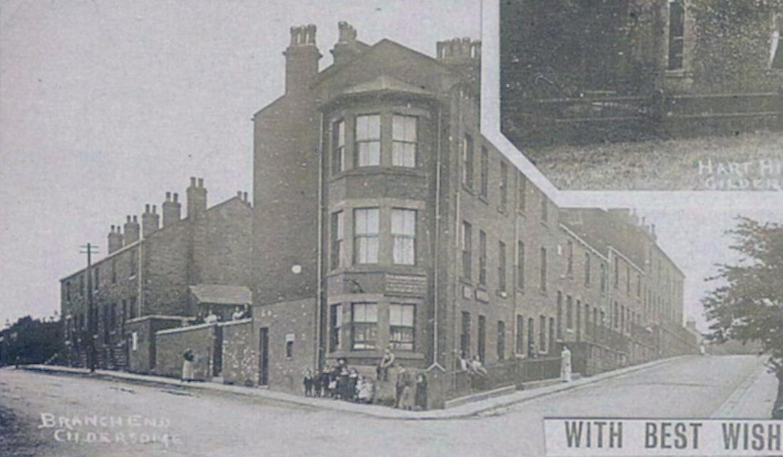
This shot was lifted from a corner of a circa 1910 postcard entitled "Scenes of Gildersome." In it, Gelderd Rd. runs off to the left and Branch End to the right. Behind, where the photographer stood, is Asquith Ave. and the "New" bridge to Morley. The terrace row on Branch was once called Ebenezer Row and the row along Gelderd was know as Woodland View. This housing was built in the 1860s or 1870s to accommodate an influx of colliery workers along Gelderd Road and mill workers at the nearby Highfield, Allied and Old Hall mills.
Maggot Row:
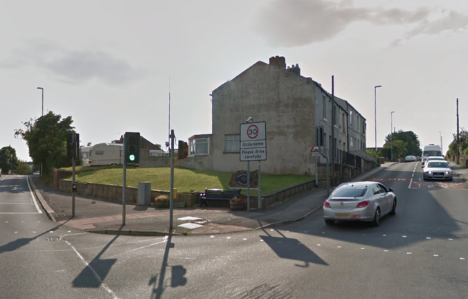
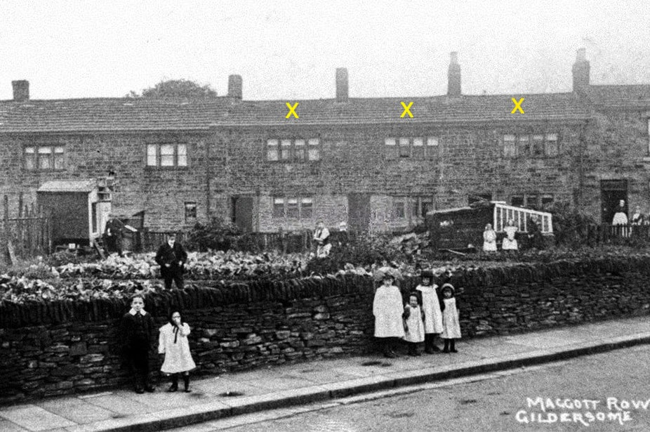
The Magate Crofts, describing the fields behind and surrounding Maggot Row in the photo above, appeared in the 1632 will of Humphrey Reyner and has survived since in various forms. Maggot Row, also called Meggit Row, didn't appear in the 1824 Gildersome Map but it can be found in the 1841 Census and on the 1843 Tithe Map. Like most of the terraced housing that sprung up in Gildersome during the 19th century, it was built to provide housing for labourers working nearby. In the 1851 Census, it was called Mount Pleasant but in every other subsequent census the name appears as a form of Maggot. The three dwellings, marked with an "X", are still standing at the corner of Branch End and Highfield Close. The building has a National Heritage Grade II listing and can be seen on the following webpage: https://historicengland.org.uk/listing/the-list/list-entry/1250173
Branch End at Woodman Lane:
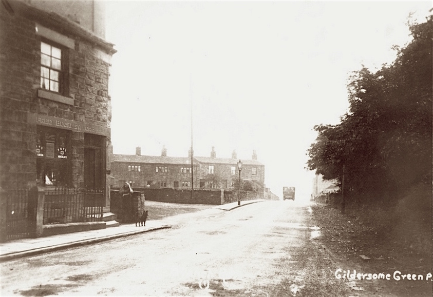
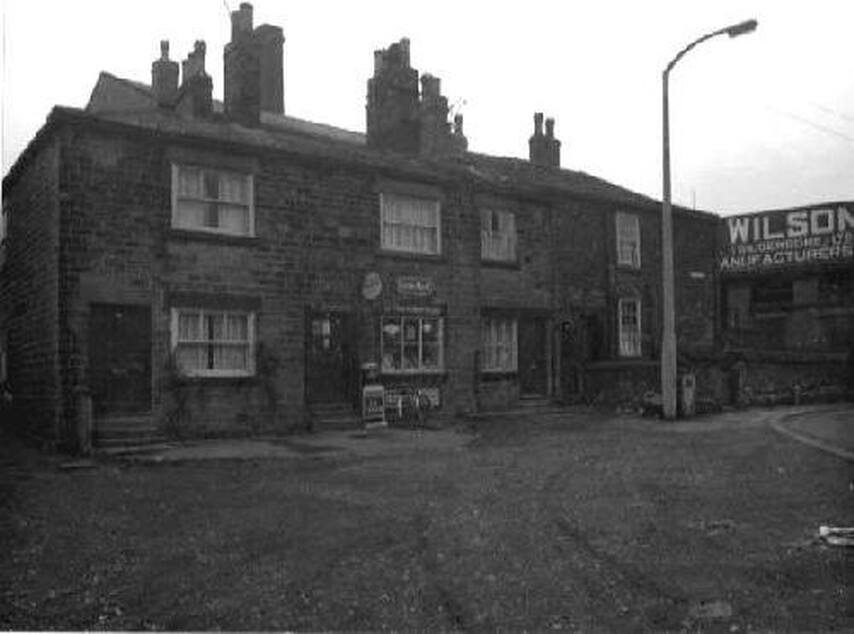
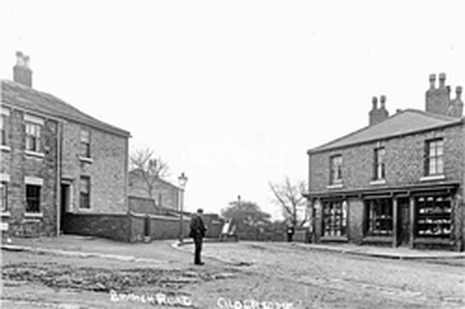
A young girl and her dog stand in front of Fred Buckley's Grocery, one of many units in a row of dwellings once known as Highfield Cottages. Behind the girl, between the shop corner and the lamp post, is the entrance to Woodman Lane. Behind that is the yard and cottages of Maggot Row (the 3 cottages on the left are extant). Across the road from the girl are trees belonging to the yard of Yarra House, located behind the trees. Down the street, to the right of the lorry, one can just make out the start of the Ebenezer Cottages.
Highfield Mills:
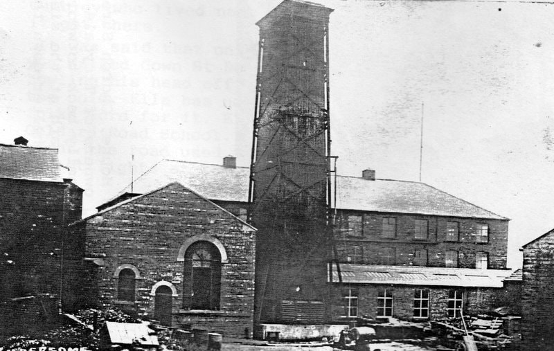
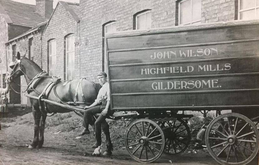
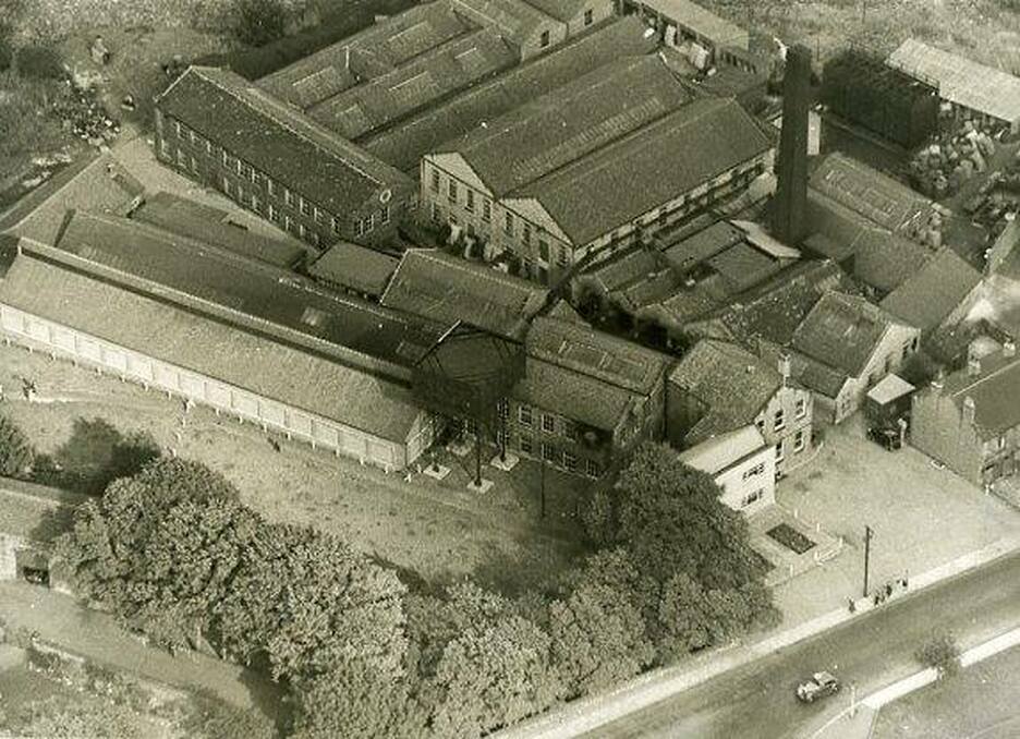
An examination of the 1850s Ordnance Map for Gildersome, revised 1856, reveals no mill at the site in the above photo. High Field Mill was the first "modern" woollen mill to occupy the site. Built by Mr. Samuel Almond, it commenced production in 1861. Mr. Almond was the unfortunate owner of Almond's Mill, once located at the end of today's College Road. In 1858, a year after the mill's opening, tragedy struck when the mill's boiler exploded and five persons were killed, six critically injured and the mill reduced to ruin. Almond then set about constructing the new mill at the site above, known today as Highfield Mills. He no doubt chose the site because of its close proximity to Gildersome's new railway station which had begun service a few years before. Its main building, seen in the background in the photo above, was brick built, 90 yards by 19, three stories tall, well lit and packed with all the latest and best technology. After pouring his time and resources into the mill, in 1864 Samuel Almond and his partners went bankrupt. The mill and its contents were ordered to be sold by auction and were purchased by Joseph Webster and Son. The mill was put up for sale again in 1884 and purchased by John Wilson who passed it on to his sons, the Wilson brothers. Highfield Mills was taken down in the early 1960s.
A Highfield Mills employee seated upon the harness trace of a Wilson Wagon (probably circa 1910)
These buildings appeared in the 1843 Tithe Map and were perhaps known as Highfield House or Farm in earlier censuses. Later, they became workmen's cottages with a shop (as seen in the photo above).
The Queen's Visit:
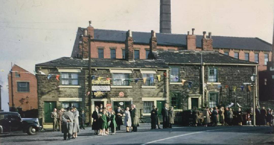
After her tour around the world, Queen Elizabeth visited Yorkshire in 1956. This photo, taken at the top of Branch Road, shows some of the crowd hoping to catch a glimpse as she motored through Gildersome. Behind the shop and workmen's cottages is Highfield Mills.
The Griffin and Nearby:
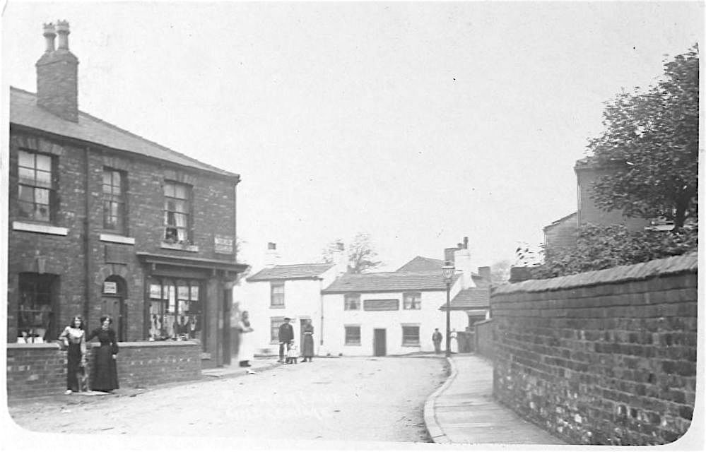
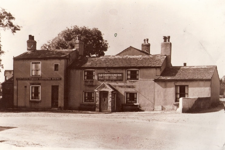
The Griffin Head Inn at the top of Branch Rd, centre. The Griffin is at least as old as 1800 and possibly older. In the photo above, the two women in the foreground, left, are standing in front of Highfield Row while a shopkeeper stands by the door of his shop at the northern end. Behind the stone wall on the right is the grounds of Highfield Mill. Highfield Row may have built in 1860, the same date as Beulah Terrace (immediately behind) and Highfield Mills.
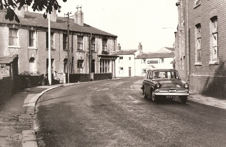
Top of Branch End, at the Griffin. The photographer has his back to the Griffin and is shooting down Branch End toward its bottom. In the distance is the location where he stood when he shot the previous photo. The same lamppost, to the left of the gentleman in the foreground, can be seen in both photos as well as the opposite corner of the same shop at the end of Highfield Row. The roof to the left of the lamp is a Highfield Mills building and the houses on the extreme left were workmen's cottages and a shop. To the extreme right, and not seen in this shot, is the intersection with Beulah Terrace.
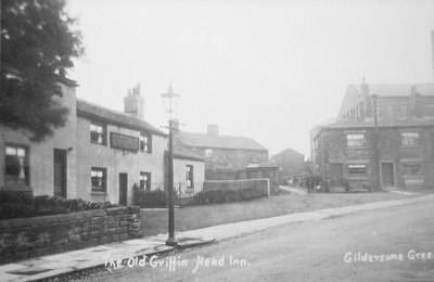
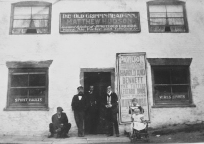
Three views of the Old Griffin Headroom the early 1900s and one from the 1950s All courtesy of the Morley Archives
Beulah Terrace:
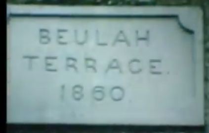
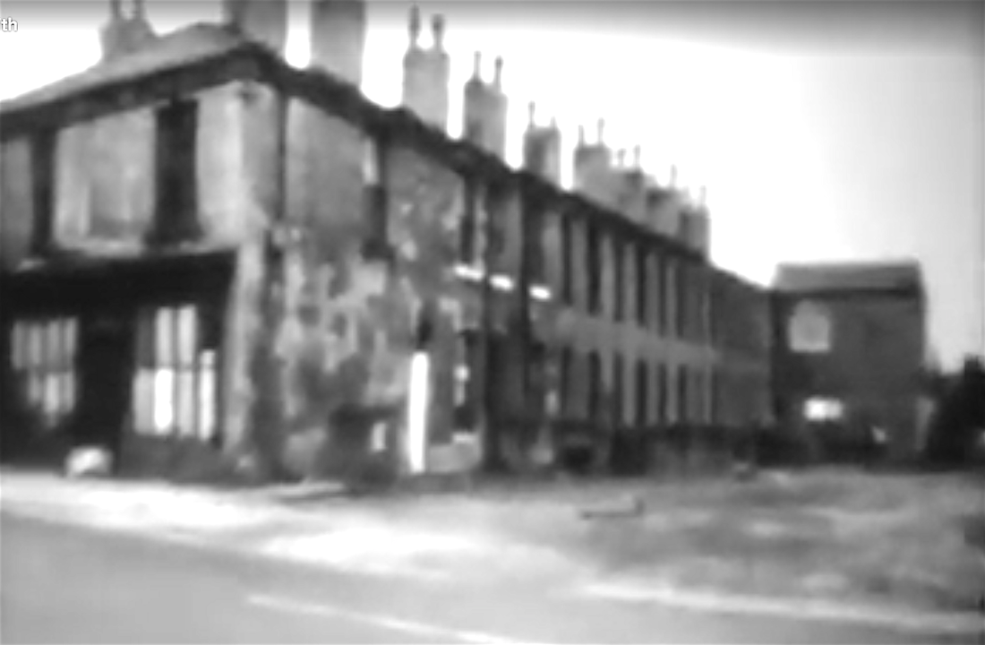
Both photos, above and left, were lifted from a frame of a home movie (hence its blurred state) shot prior to its demolition in the 1960s. To my knowledge, no other closeup of Beulah Terrace exists. The shot of the terraced houses was taken from Town St. and contains only the eastern half of the site, the western side would have looked much the same. Behind the eastern side, Highfield Row sat back to back with Beulah Terrace and shared a common end where the shop can be seen in the 'Top of Branch End, at the Griffin' photo, above. What was once called Beulah House can be seen at the terrace end extending out at a 90° angle. 1860, the year of Beulah Terrace's occupation, was a time of rapidly expanding growth for Gildersome. Without a doubt, Beulah Terrace was built to attract a labor force. Courtesy of Joyce Smith
Looking west from the Griffin:
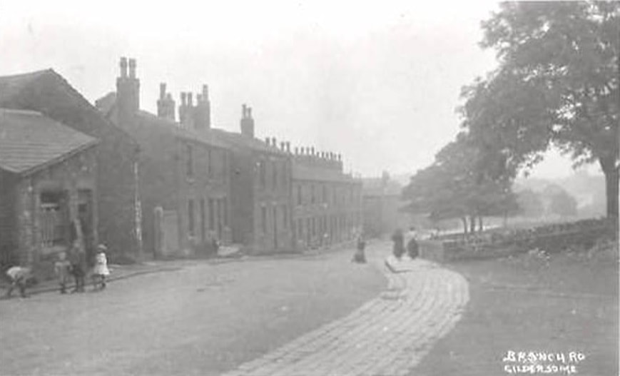
The structure on the left, behind the group of children, appears to be two buildings, but is in fact one structure (probably belonging to the Old Hall mill). Though it's hard to make out, to its right is a gap which was the entrance to the Old Hall Mill situated immediately behind. After that, Webster Row then carries on into the distance. The fields behind the fence on the right belonged to Harthill House.
Gildersome's Old Hall and Mill:
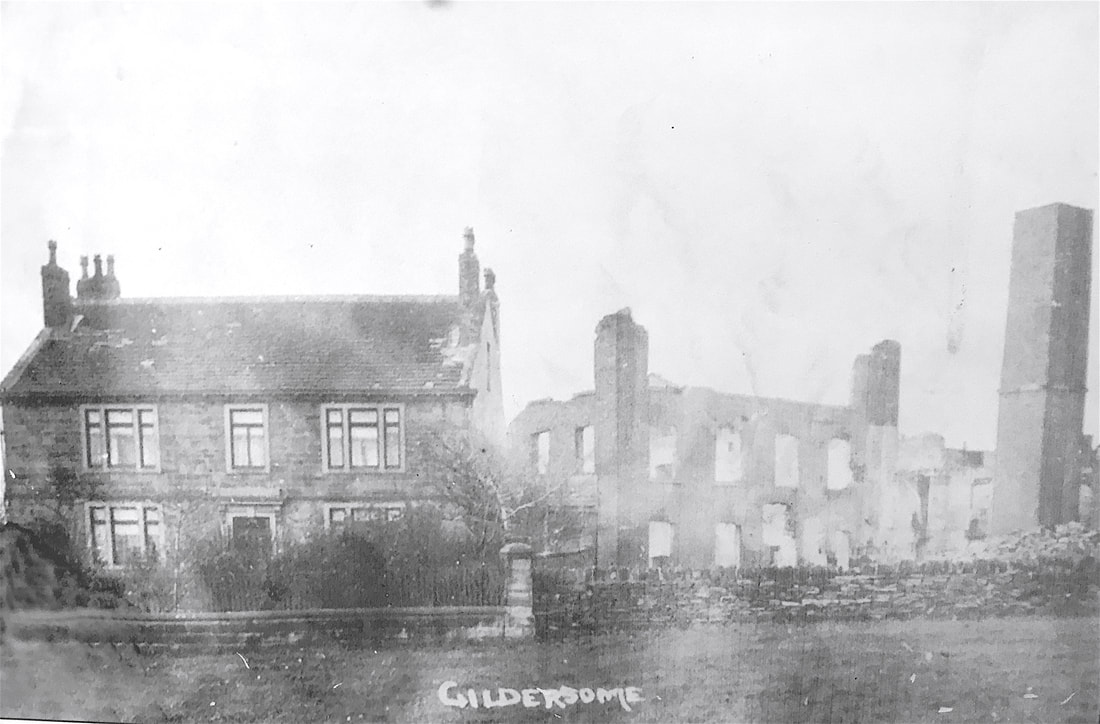
Parts of the Old Hall's original structure were first built in the Tudor period. The house then went through many alterations during its lifetime. It probably assumed its square footprint sometime during the 18th century. In the 19th century it was described as being 17 yards in length and breadth which equals about 2600 square feet per floor. It survived until the 1970s. On the 1800 Enclosure Map for Gildersome the mill as appears as an operational flax mill. It's not certain when fire destroyed the mill, as seen in the photo above however, in an 1948 map the mill does not appear along with the caption "ruins." The chimney on the photo's right seems to lean due to a distortion in the image, it actually stood upright. For more see: Old Hall
Webster Row:
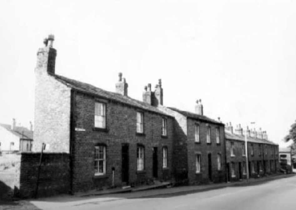
Behind Webster Row stood the Old Hall and the Old Hall Mill. Visible at its east end is a shop which can be seen in the following photo. As its name implies, it was erected by Joseph Webster, in the 1860s or 1870s, who operated the Old Hall and Highfield Mills at that time.
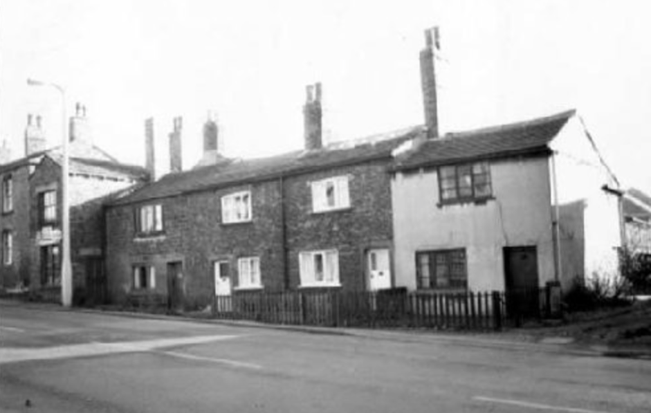
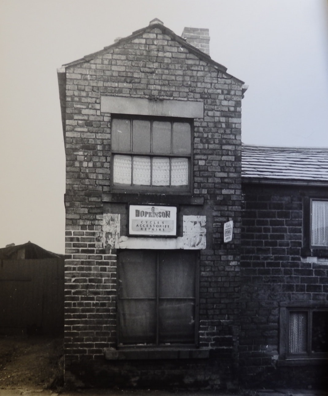
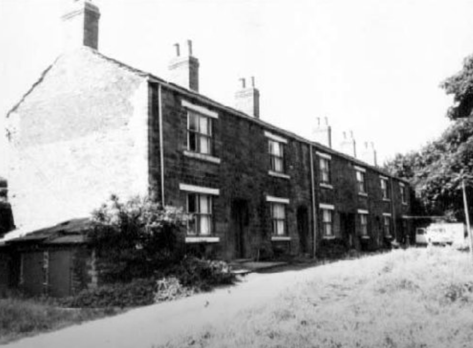
These four set-back cottages can be found on the 1843 Tithe Map. Jutting out at the left end is a shop and to the left of that, at the edge of the photo, is the west end of Webster Row. This row was identified as Willow Garth in the census.
G Hopkinson's Cycle Shop
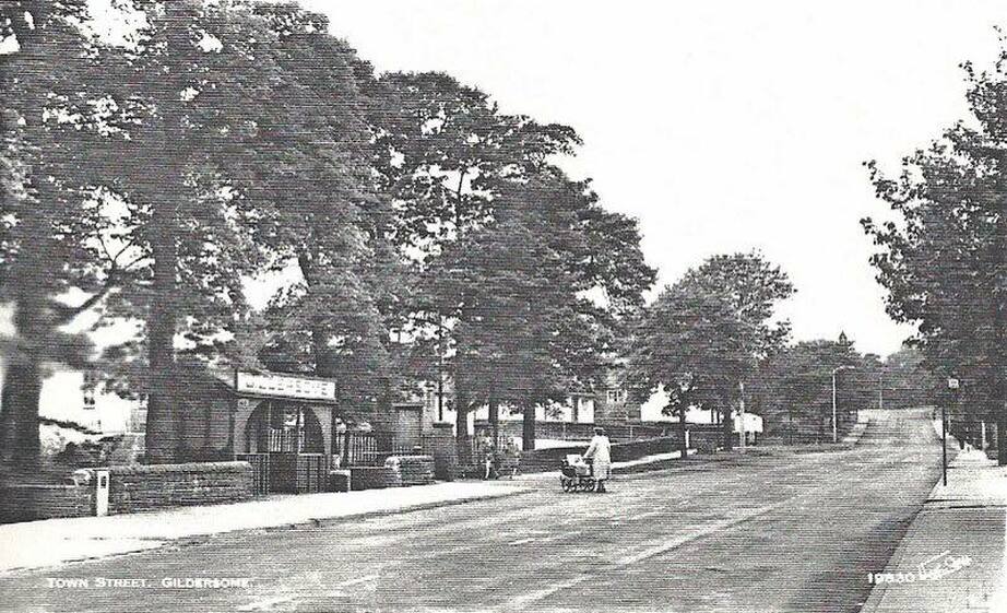
Town Street near College Road:
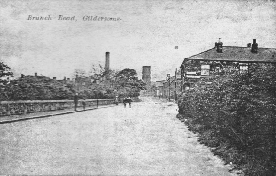
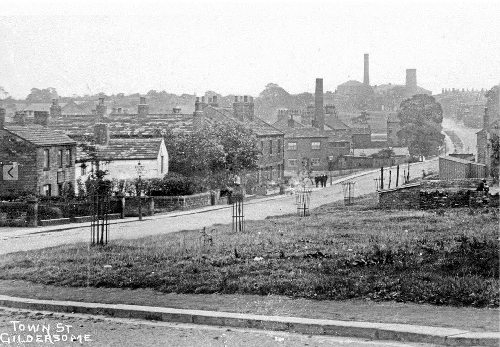
The sidewalk and stone fence to the left borders on the fields of Harthill House. The hedge on the right stands before the orchard at Turton Hall and beyond it lies the entrance to College Road. The first building on the right is a portion of Willow Garth Terrace and after that is Willow Garth and Webster Row fading into the distance. The roofline and chimneys on the left above the trees is the Griffin Head Inn, and the tall chimney and cooling tower belongs to Highfield Mills on the far side of Branch End.
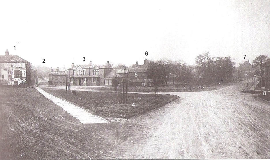
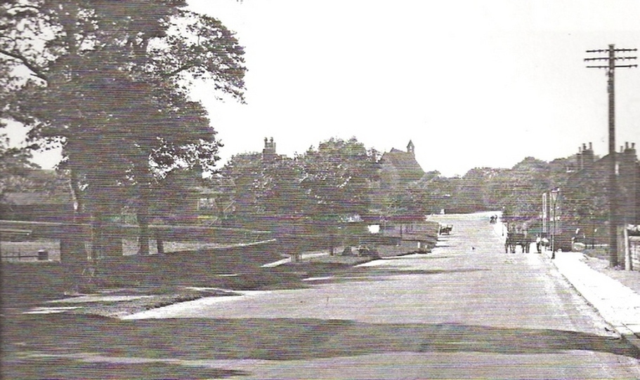
The Green circa 1910:
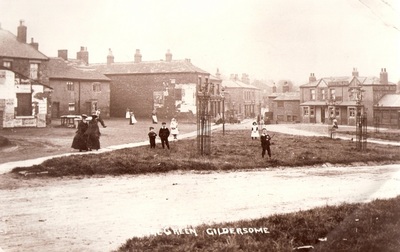
It's almost as if the photographer, who took the shot immediately above this photo, turned around, took a few steps and shot this wonderful photo of Gildersome's Green.
|
5. Grove Yard
6. Chimneys of Grove House 7. St Peters 8. Shop then, Karen's Pantry today |
See more on The Green at: https://www.gildersome.net/green--finkle-lane.html
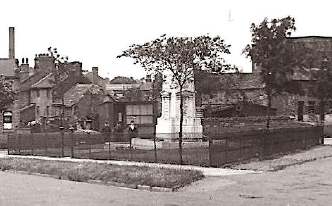
The War Memorial...behind is the Old Factory Yard and Maiden Mills is on the right. For more on the War Memorial see: War Memorial Dedication and Gildersome's Fallen Heroes
Grove House:
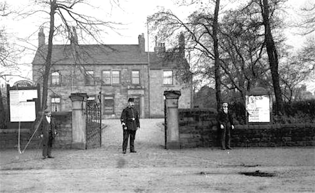
Erected or added to between 1825 and 1845. It became the home of Stephensons before they fled to Harrogate. At the time of the photo, c. 1910, it was the offices of the U.D.C. The Gildersome Meeting Hall and Library presently occupy the spot. Photo Courtesy of Joyce Smith
Grove View and Gelderd House:
Gelderd House (right) was built in the 18th century by the Sharp Family and was then known as Sharp's House. It acquired its present name when the Gelderd family purchased it around 1850. After that, the attached building, barley visible on the extreme right, became known as Sharp's House. The terraced units with the bay windows were built sometime around 1900. Behind these houses sat the Old Factory Yard.
Little Green:

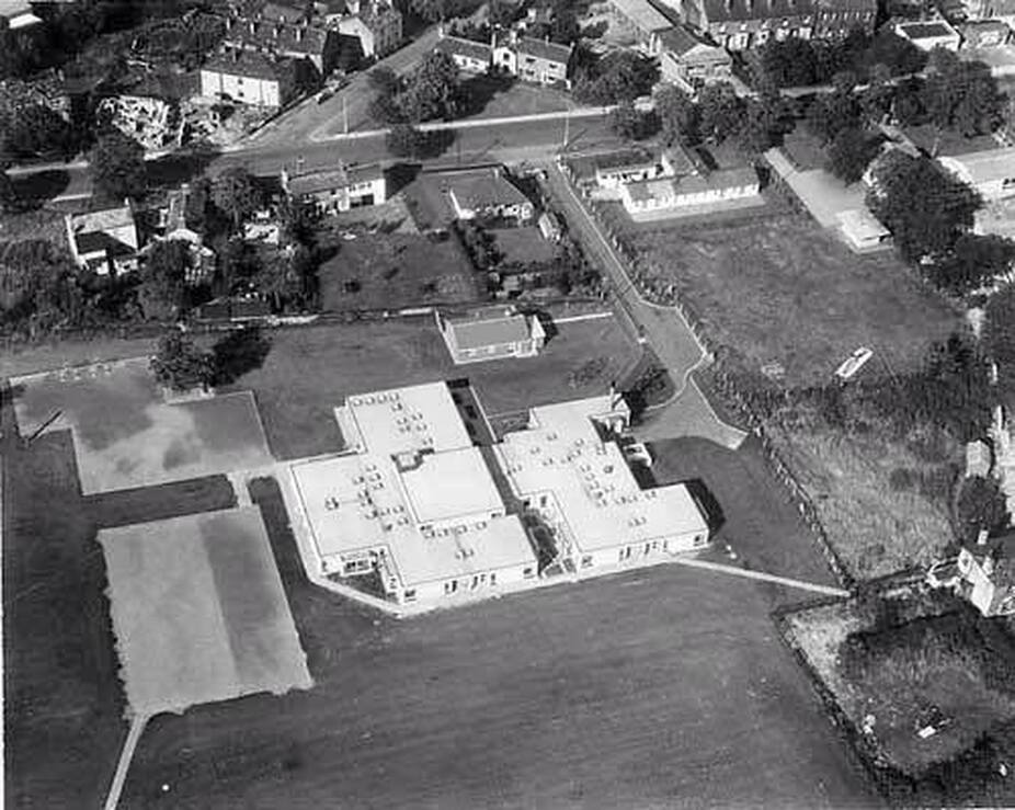
Gildersome Primary:
Town Street near Mill Lane:
Looking east toward St Peter's Church. Street Lane bends off to the left and Church St. to the right. Mill Lane intersects near the lamp post to the right. This shot was taken at nearly the same spot as the later photo below.
Oak Dean on Town St.
Friend Cocker and family standing before Oak Dean.
Rose Cottage:
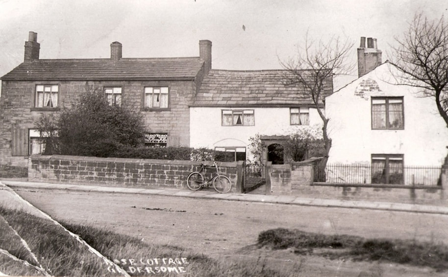
These buildings were extant in 1800 and in time became known as Buttrey's Farm. In 1910 it was occupied by the Cocker family and soon thereafter the portion on the left was removed and replaced by Oak Dean (see above). Though this c.1910 postcard's caption reads "Rose Cottage Gildersome," National Heritage Listings recognises a cottage across, and slightly down, Town Street as being called Rose Cottage (See photo below).
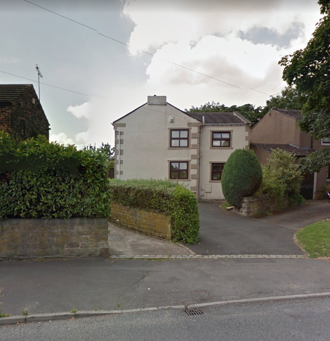
This Rose Cottage has been given a Grade II National Heritage listing. A plaque is still affixed above the entrance which gives the date of its construction, "1760", and that of its builder, "JW" (at the moment, John Walsh appears to be the likeliest candidate).
See the Listing at: Historic England
See the Listing at: Historic England
|
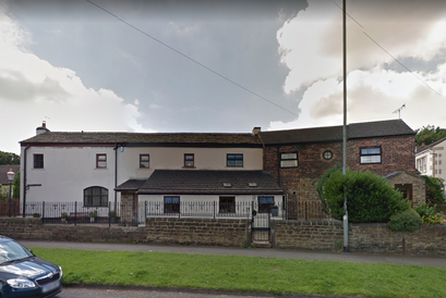
The listed Rose Cottage was part of an old farm complex that can seen on the 1800 Enclosure map, parts of which can be seen in the photo, right. The light coloured building, above, appears on the 1800 Enclosure Map without its front extension. The attached stone building to the right does not though parts appear to be pretty old.
|
Intersection with Forest Bank:
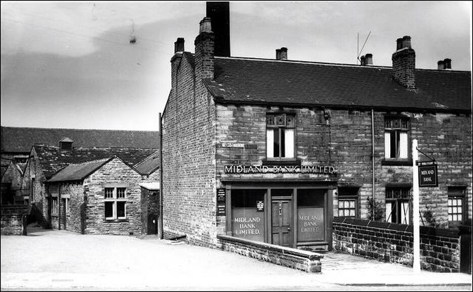
Midland Bank circa 1950s. This terrace row of workmen's cottages appeared after the 1850's. Over time the end unit has been a shop, a post office circa 1910 and recently an estate agent's office. Behind are buildings and a chimney belonging to Springfield Mills. The Mills' property was once the site of Gildersome's Liberal Club and before that Buttrey's Farm.
Peggy Tub Row:
Peggy Tub Row was built sometime between 1824 and 1843, most likely to provide housing for workers at Gelderd's Mill (Old Factory Yard) and Brown's Flax Mill (site of Maiden Mills).
Springfield Mills circa 1940s:
Erected circa 1912, Springfield Mills was a latecomer to Gildersome's woollen industry. The land upon which the mill occupies, once called The Revil Ing, was purchased by William Morris of Springfield House, from the Gildersome Liberal Club.
Town St. and Street Lane, circa 1910:
The photographer, who took the shot, was standing on Street lane south of the corner of Town St. and Street Lane. Rose Cottage is on the left. Where the three men stand is the intersection at Mill Lane and behind them is Little Green. The chimney in the foreground was left over from the old Gelderd Mills and behind that is Grove View. In the distance is the chimney and cooling tower of Highfield Mill. Beneath the cooling tower and partially obscured by the tree is the present day sandwich shop. The Gildersome Conservative Club now occupies the the grassy area in the foreground. With thanks to Andrew Bedford
