Use pull down menus above to navigate the site.
** NOTE** To see other areas of Gildersome, use the thumbnails below to open the pages.
Gelderd Road, its Vicinity and the Railway © 10/09/19 by Charles Soderlund
with special thanks to Andrew Bedford
Introduction (photos below):
Before Gelderd Road's creation, the shortest way by coach or wagon from the centre of Gildersome to Leeds was to take Street Lane to the Wakefield & Bradford Rd, then to Bruntcliffe and from there to Leeds (the Leeds & Elland Road). For those in Gildersome, this route through Morley added over a mile to the trip, which meant extra fees charged by carters as well as an additional charge of tolls at the Street Lane and Bruntcliffe bars. If one wanted to walk, ride a horse or pull a small cart, the best route to Leeds was 'The Old Leeds Road' beginning at Gildersome's manor, over Harthill (a footpath today) to the junction with Rooms and Trench lanes then along Farnley Wood Beck to Churwell.
By the end of the 18th century the need for a shortcut from Leeds to Huddersfield gained the attention of the government and the public at large. In June of 1815, a 'Meeting of the Proprietors of Estates' chaired by Watson Scatcherd was called to exhibit the proposed routes and discuss the project i.e., its impacts upon the economy and possible land appropriations. The project was received favourably and a spate of regular meetings then ensued. Eventually a grand plan was adopted called the Leeds to Huddersfield Turnpike, to be built in two phases, first the Leeds to Birstall road through Gildersome then, after completion of the first phase, work on the Birstall to Huddersfield road would begin. At first the plan for Gildersome's portion was set to follow an ancient lane from Roomsbridge to the Griffin Inn, then pass through town to Street Lane but that was scrapped in favour of its present course.
Construction began in the latter half of 1823, and though I haven't found a 'grand opening' date for the road it appears to have been completed by the end of 1825. There are three likely theories as to how the road came to be called Gelderd Road. The first explanation is that it was named for Mr William Gelderd of Gilead House, Gildersome, a mill owner and property holder through which the road passed. The second is that it was named after one William Geldert, at that time a West Yorkshire Surveyor of Highways and overseer of the project. The third is that both Williams were the same person.
Gelderd Road brought Gildersome an easy access to Leeds and transformed it from a sleepy out of the way village taking it right into the centre of the industrial revolution. Seemingly overnight mills, collieries and other steam powered trades appeared, fuelled by readily available high grade coal and abundant water. This attracted labourers in need of work and in less than twenty five years, Gildersome's population had tripled.
The following picture history starts at Old Rooms Bridge above Philadelphia and follows Gelderd Rd. south to its intersection with the Bradford and Wakefield roads (The Street).
|
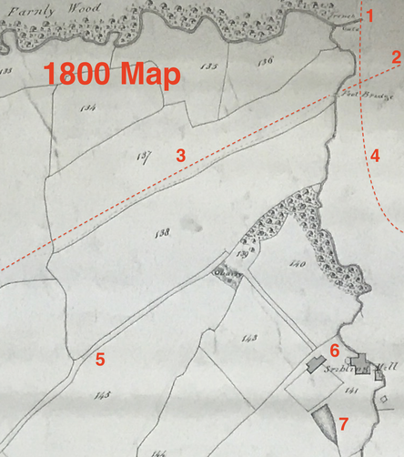
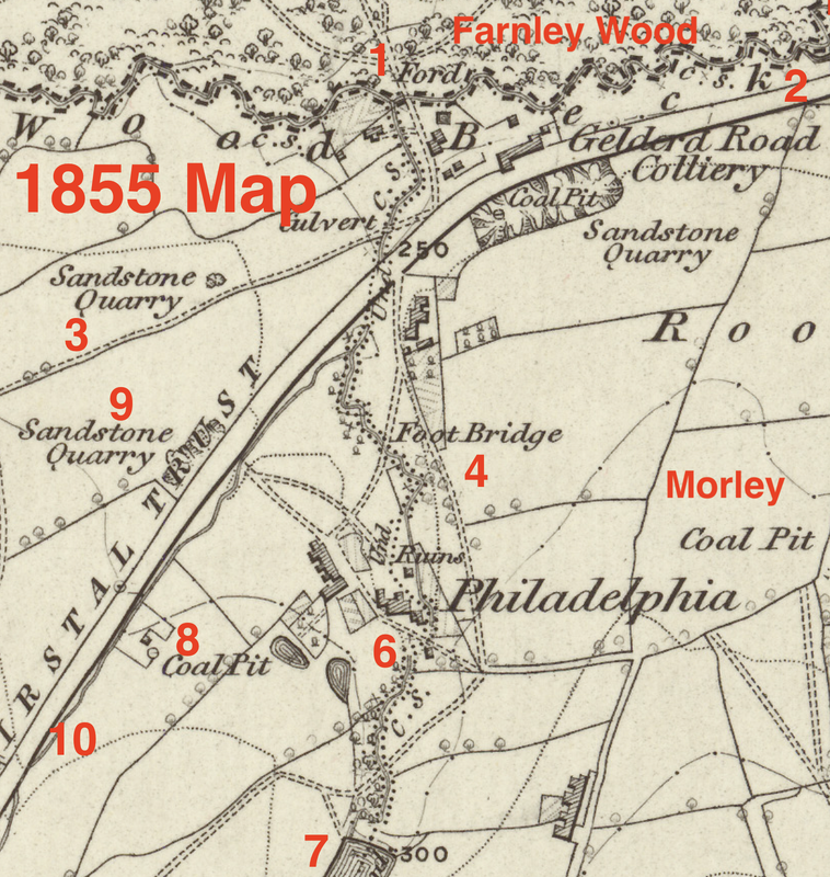
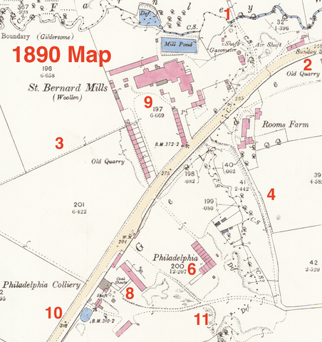
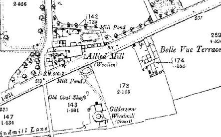
To help understand the northeast corner of the Township of Gildersome, these three maps are intended to demonstrate 90 years of change; from 1800 to 1890. Use it as a reference for the first five sections of this page.
|
The Trench Gate:
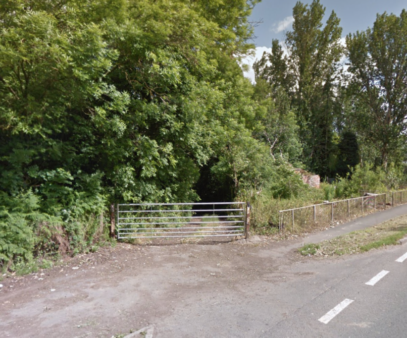
Today's Trench Gate along Gelderd Road, bars entry to Trench Lane (found marked on the 1800 map) which runs in an arc through Farnley township to Upper Moor Side (today most of it is called Wood Lane). In 1663, near this spot was the junction of four back country roads; one to Gildersome, another to Farnley, a third to Morley and the most important of all a road to Churwell where one could pick up the high road to Leeds. In all likelihood, at that time the area surrounding the junction would have been within Farnley Wood. This secluded location would have been easy, even at night, to find by men who were familiar with the area and quick and easy access to the Leeds road would have made this an ideal assembly point for those wishing to maintain a low profile. In my opinion, on the night of 3 October 1663, a spot very close to this gate is the most likeliest gathering place for the Farnley Wood plotters. (see the 1800 map above)
St. Bernard's Mill:
|
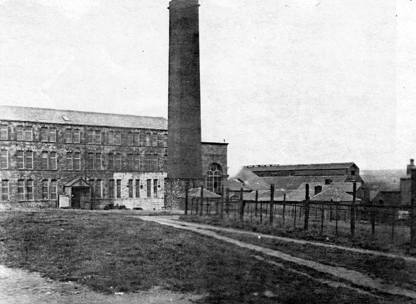
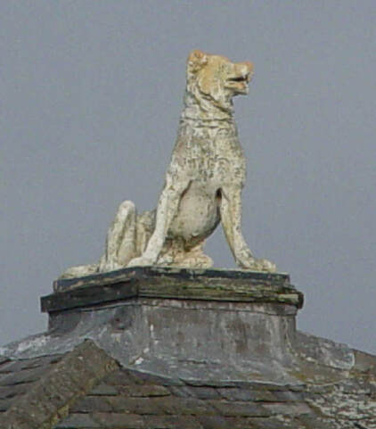
According to a long standing St. Bernard's Mill legend, a barking St. Bernard alerted the sleeping owners to a fire at the mill which was quickly extinguished. The grateful owner then changed the mill's name in gratitude. Whether the story is true or not remains to be seen.
Left, this statue, supposed to represent a St. Bernard, graced the roof of the mill's main office for at least a century, if not longer. St. Bernard's Mill was built in the 1870s on the site of an old sandstone quarry. St Bernard's owner at that time was George Webster who also built and resided at the Woodlands. Before that, he lived at Park House, Gildersome so its not likely that the story of the dog waking its owner is true. |
|
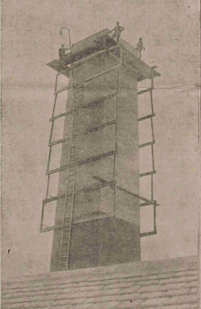
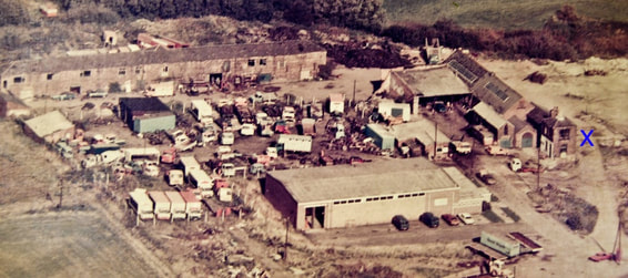
In 1902 the mill was put up for auction but was withdrawn when the highest bid offered, £5,750, below the asked starting bid, was turned down. The mill did eventually sell and continued operations (Shoddy) until after the second world war, and later it was abandoned in the 1970s. In 2010 the mill was purchased by Associated Waste Management Ltd. (AWM). Right, in 1906, a lightening strike tore a twenty foot gash in the side of St. Bernard's chimney. The repair was performed by Messrs. M.T. Austin & Sons of Leeds whose workmen can be seen perched atop their completed handiwork. |
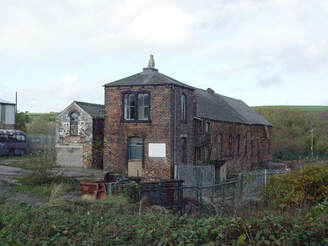
In the photo left, is the old office topped by the dog statue prior to construction of the waste facility. In the photo on the right, what's left of the mill can be seen after the main building had been removed. The 'X' marks the location of the old office which is still in existence though topped with a more suitable St Bernard facsimile.

Philadelphia:
Philadelphia was an area of Gildersome township that was probably named by the Quakers in the early 1700s for its remoteness, a once common practice (another example is Nova Scotia, or "Novy" near Philadelphia along Farnley Wood Beck). Philadelphia was the site of Philadelphia Mill, one of three pre-19th century steam powered scribbling mills in Gildersome township, the others were located at the Old Hall and the future site of Maiden Mills.
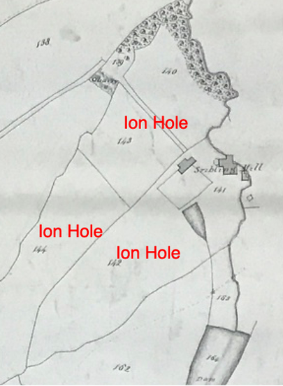
Why, in 1800, would a mill with the latest in technology be located far off the beaten track? The answer may be pre-existing infrastructure. In the 1800 map, (left) can be seen three fields that were called 'Ion Hole,' probably an evolved pronunciation of 'iron hole.' In addition, the water features on the map, such as the large dam, millrace and collection pond, suggest that Philadelphia had been worked for quite some time, perhaps during the Middle Ages or early Tudor periods. Gildersome was, and probably still is, rich with readily accessible iron ore and documentation exists mentioning extensive iron mining taking place there in the 1500s. It was around that time, or perhaps a bit earlier, that water powered bellows were introduced to West Yorkshire, they were used to decrease the smelting time thereby increasing output. It seems a natural assumption, after reviewing the evidence, that Philadelphia was one of these smelting sites. Philadelphia is not the only possible watermill site in Gildersome, evidence points to The Bottoms as having once been the location of a watermill. By the turn of the 17th century, economic pressures put an end to most ironworking in Gildersome. see: Ironworking in Gildersome
Why, in 1800, would a mill with the latest in technology be located far off the beaten track? The answer may be pre-existing infrastructure. In the 1800 map, (left) can be seen three fields that were called 'Ion Hole,' probably an evolved pronunciation of 'iron hole.' In addition, the water features on the map, such as the large dam, millrace and collection pond, suggest that Philadelphia had been worked for quite some time, perhaps during the Middle Ages or early Tudor periods. Gildersome was, and probably still is, rich with readily accessible iron ore and documentation exists mentioning extensive iron mining taking place there in the 1500s. It was around that time, or perhaps a bit earlier, that water powered bellows were introduced to West Yorkshire, they were used to decrease the smelting time thereby increasing output. It seems a natural assumption, after reviewing the evidence, that Philadelphia was one of these smelting sites. Philadelphia is not the only possible watermill site in Gildersome, evidence points to The Bottoms as having once been the location of a watermill. By the turn of the 17th century, economic pressures put an end to most ironworking in Gildersome. see: Ironworking in Gildersome
|
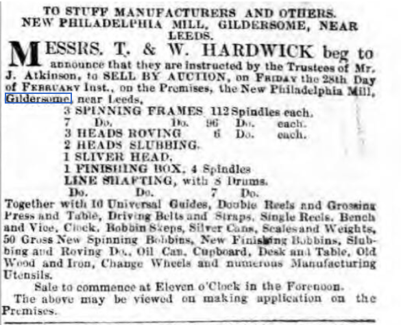
In the early 1800s, the scribbling mill known as Philadelphia Mill was owned by William Geldard & Sons. William Gelderd of Gilead House was probably the same Wm. Geldert, who was surveyor of West Yorkshire and for whom Gelderd Rd. was named. Though owned by the Gelderd family, its doubtful whether they operated the mill, opting instead to lease out the space, equipped or not. The clipping to the right, is a good example of the equipment at the mill in 1845. It's unclear whether the items being sold are part of a bankrupt sale, estate sale or because the machinery was obsolete.
|
By the 1840s, it appears that activity at the mill was falling off and that the nearby Philadelphia Colliery and later St Bernard's Mill was was attracting more of the area's work force. The 1851 census shows a mixed bag of coalminers and millworkers living at Philadelphia but by the 1861 census, the mill (called Gelderd Mill in that year's census) was still in operation but only a few of Philadelphia's residents are employed there. By the 1871 census, the mill has shutdown and the main occupation of the nearby residents is coal mining.
Gildersome Goods Station:
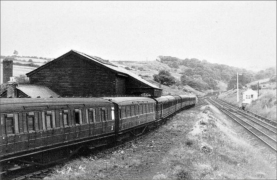
The London and North Western Railway's Gildersome Goods Station, looking south toward Whin Hill and the tunnel just beyond the bend. The line between Leeds and Huddersfield was opened to passengers on November of 1900. In addition to passengers, the Gildersome station was positioned in order to easily load coal from the Philadelphia Colliery and access St. Bernard's Mill.
Photo courtesy of Facebook's: Gildersome, Past Present & Future
Photo courtesy of Facebook's: Gildersome, Past Present & Future
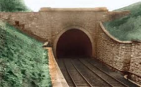
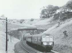
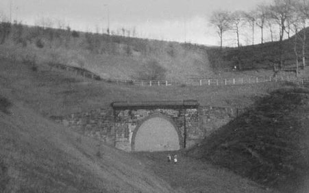
From Leeds, the London and North Western Railway's line followed Dean Beck through the first portion of its passage through Gildersome. When it reached a spot just behind the Woodlands, it went underground; the photo left is the tunnel entrance. The tunnel then made a straight shot of about 1 ¼ miles before emerging in Howden Clough, photos middle and right. The line was abandoned in 1965.
Churchill in Gildersome?
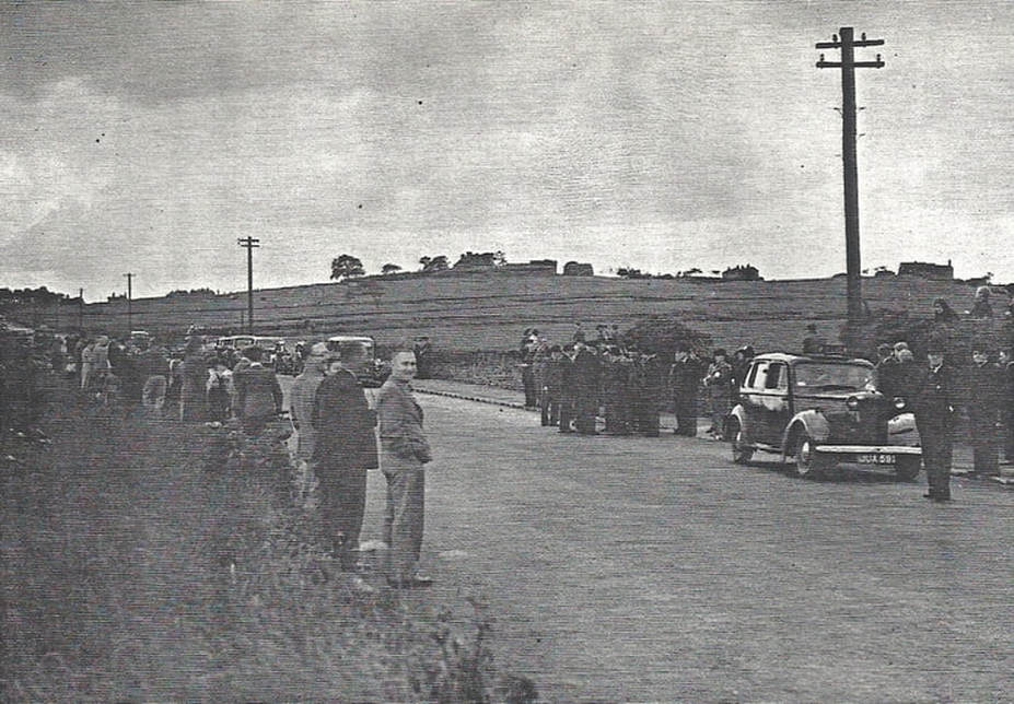
People gather on Gelderd Road in hope of catching a glimpse of Winston Churchill as he motors by on his way to Huddersfield. On 8 April 1951, Churchill was scheduled to make a speech that evening at the Town Hall in Huddersfield in support of Liberal candidate for the Colne Valley division, Lady Violet Bonham Carter. If Churchill arrived by train at Leeds and proceeded to Huddersfield by limousine, he would have passed this very spot. Gilead House and Cricket Hill are recognisable on the crest of the rise beyond the crowd,
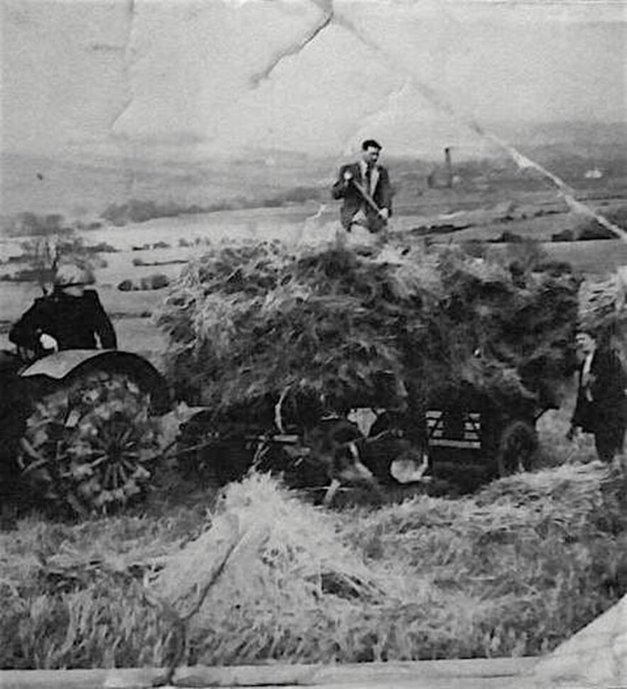
"Salvaging barley after weather havoc"
The photo above appeared in the Yorkshire Post on March 16, 1955 along with this accompanying article:
"Useful only as food for pigs and poultry.... Stocks of corn---relics of the bad weather in late summer and autumn---make a gloomy spectacle still on some West Riding hillsides, Rain, snow, wind and birds have taken their toll of the grain, yet many farmers are determined to salvage what is left.
Mr. Leonard Cocker, of Harthill House Farm, Gildersome, near Leeds, yesterday took out a tractor and trailer to lead in as much as was worth while of 2 ½ acres of barley. "It will not be worth threshing, for the pigeons have created havoc among the stooks, but it may be useful for the pigs and poultry." he told me. Mr. Cocker said that he had farmed at Gildersome for 20 years and had never known such bad conditions for harvesting."
The Haunted House:
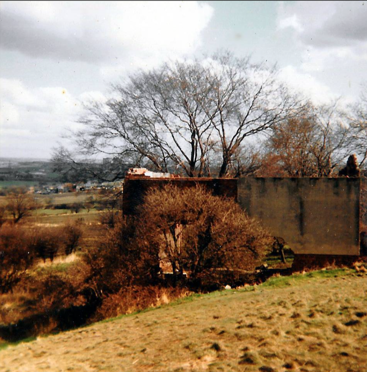
Today, not much is known or even remains of Harthill Farm, better known as "the Haunted House." Situated on the slope of Harthill along the Old Harthill road to Leeds, It doesn't appear in the 1850s O.S. map but is visible in the 1890s map so presumably it came into existence sometime between the two dates. By 1960, it was abandoned and over time sank into ruin.
Cricket Hill:
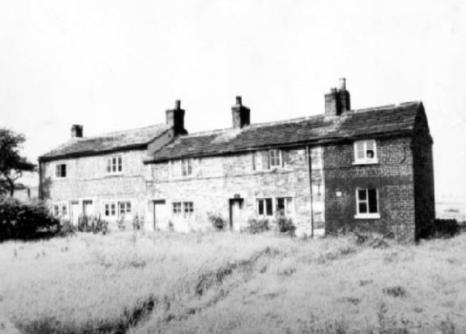
Called Cricket Hill Farm, before the 1860s it was part of Gelderd's 90 acre farm. After that, and until it was knocked down, it became the abode of workers.
Gilead House:
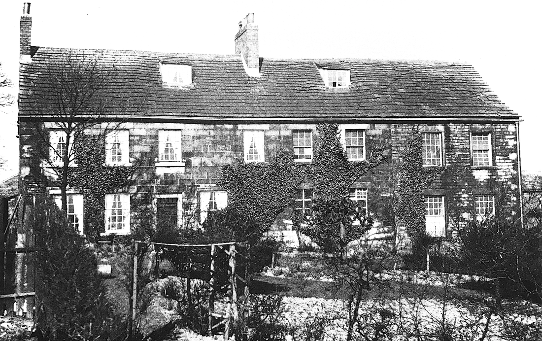
Parts of Gilead House probably date back to the late 1600s or early 1700s when the Hargreaves family were its occupants. When the last Hargrave died in 1749, Bolton Hargreave, he left an endowment called the Bolton Hargrave Charity which enabled ten Gildersome boys from poor families to be educated free of charge. The charity was financed by rent from three cottages situated on the site across from the New Inn where the Church School used to stand. Hargreave's heirs chose to sell Gilead House and farm (56 acres) and around 1752 it was purchased by James Maude, this is about the same time that Maude purchased Turton Hall. After Maude's passing his executors leased Gilead House and 50 acres of surrounding fields to the Quakers.
In the 1790s, the quakers had been looking for property to establish a 'Workhouse School' for the children of poor Quaker families. They finally settled on Gilead House which was a ;
In the 1790s, the quakers had been looking for property to establish a 'Workhouse School' for the children of poor Quaker families. They finally settled on Gilead House which was a ;
"large commodious house, in a fine airy and healthy situation, about four miles from Leeds, and half a mile from Gildersome Meeting..........They have provided a master of character & conduct, who is well qualified to teach reading, writing, and accompts; another to instruct the boys in such parts of the woollen manufactory, and occasionally in husbandry, as they are capable of; and a mistress to instruct the girls in spinning, knitting, sewing &c., and with proper assistants to manage the house, and a man to direct and assist in the husbandry business."
The school was a success but closed its doors in 1815 after the retirement of the headmaster, John Ellis. Gilead House was then occupied by William and Hannah Gelderd. I'm not certain whether they owned or leased the house and croft but they certainly leased most of their farmland from Benjamin Gaskell, of Thorne House, Alverthorpe (Wakefield) and his heirs. Gaskell, Maude and the Milnes families (all of Alverthorpe) were apparently related and possibly connected to the Hargreaves (I haven't worked out all the connections yet), collectively they owned over a third of Gildersome Township. The Gelderds oversaw a farm of 90 acres, owned Gelderd House across from Grove House in town, and owned two mills, one at Philadelphia and one at the Old Factory Yard next to the Green. William Gelderd passed in 1839 but Hannah lived on until the mid 1860s. Her heirs chose to sell off all of her Gildersome property and thus ended a fifty year occupation. After that, Gilead House had several lease holders, the most notable being Miles and Thomas Verity. Sometime after 1910, Thomas Verity purchased Gilead House and Farm from the Gaskells. Today, Gilead House Farm is a business providing Kennels, a Cattery and Livery Stables.
|
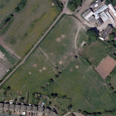
In this recent aerial shot, Gilead House is in the upper right corner. Surrounding the house and farm buildings, the configuration of the fields are nearly identical to their counterparts in the 19th century, in fact many may go back centuries. The two fields in which can be seen circular impressions (most likely from iron pit mines) are called Cinderhill and Clay Croft, both are ancient names associated with ironworking. The site surrounding Gilead House is rich in iron ore that can be found in a strata close to the surface. It's quite probable that mining and smelting activities at this site predates the works at Philadelphia. see: Ironworking in Gildersome
In two strange coincidences, the name Gilead House is quite similar to Gildersome's medieval name Gildhus meaning 'Valley House'. And, one of the several translations of Gilead is 'Mountain of Stones'. |
Gelderd Road School:
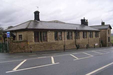
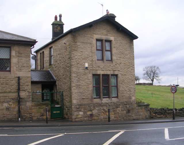
On the first of February 1875, the Gelderd Road and the Street Lane Schools officially opened and notices were sent to parents that attendance was compulsory and would be enforced. In roughly four years, the Gildersome School Board had successfully built two new schools and fully carried out the required provisions of the Education Act, one of the first districts in the country to do so. At the time, the School Board believed that there would be rapid population growth along Gelderd Road, which explains its rather remote location.
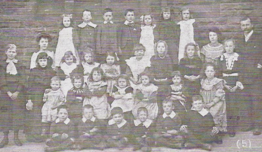
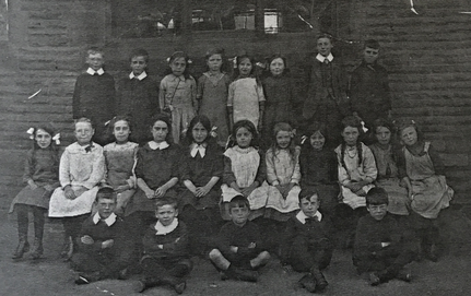
Gelderd Road School children circa the 1890s.
Bell Royd, above the Woodlands:
The Woodlands:
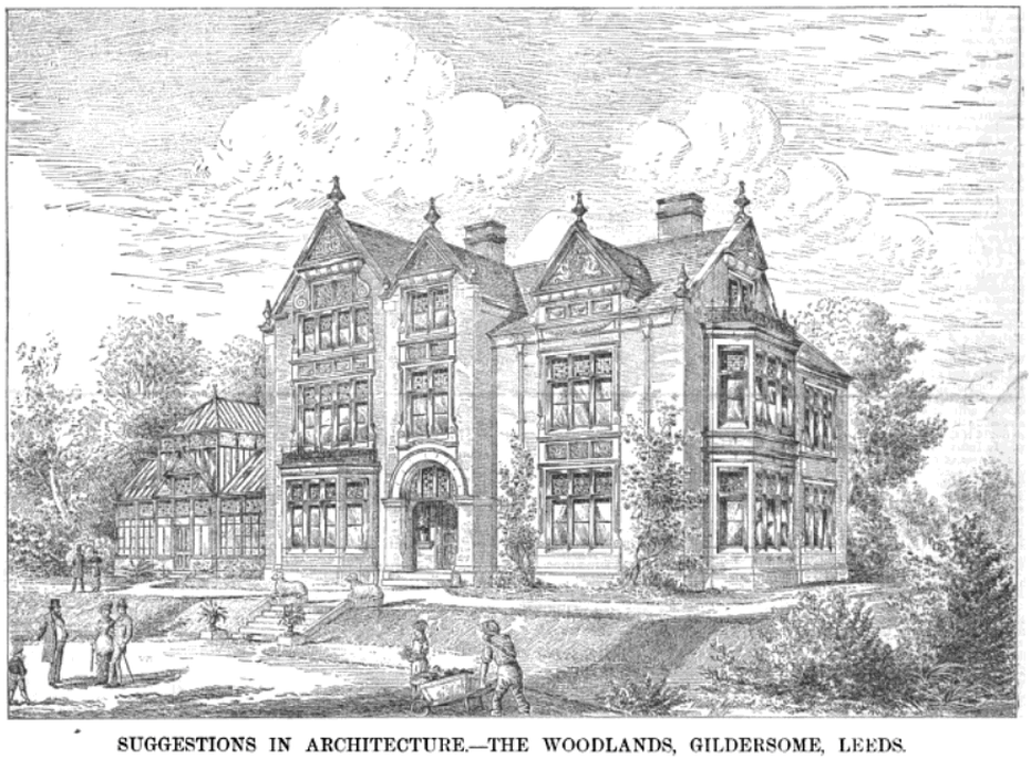
The magazine, Scientific American Supplement Vol. 15 1883, published the following under the heading of "Architecture":
"THE WOODLANDS, GILDERSOME, NEAR LEEDS. The house and premises shown in the illustration belong to Mr. George Webster, manufacturer, of Gildersome and Leeds, and a member of the Leeds Town Council.
The grounds and park, which are away from the village, are 23 acres in extent, falling gradually to the south, which is bounded by a small run of water and a wood behind it.
The house has a dining-room (24 feet by 16 feet 6 inches) , hall (10 feet foot wide), drawing and breakfast rooms, front and back kitchens, pantries, lavatory, etc, on the ground floor. On the chamber and attic floors there are ten good bed-rooms, closet, w.c., rooms for bath and lavatory, which is fitted up with the ordinary slipper bath for hot and cold water, steam bath, douche bath, and a circular needle bath. The room has a fireplace, and in addition has a small heating apparatus for winter, supplied from the kitchen fire.
The material used for the external walls is the best Delph stone all round, with hard white ashlar dressings. Pitch pine is used extensively in the inside, and the whole of the woodwork in the dining-room is in solid mahogany, French polished and picked out in black, and the suit of furniture for this room is in mahogany to match, and of the same period as the house, specially designed by Mr. Charles Mills, of Bradford. All the reception-rooms have ceilings divided into small panels and well filled with ornament.
The outbuildings comprise stables, loose box, harness-room, coach-house, wash-house, lodge for coachman, garden-house, conveniences, billiard-room, 32 feet 6 inches by 18 feet, and 13 feet high. The court-yard of house and stable yard are quite separate, and the latter cannot be seen at all from the kitchen.
The vineries are 120 feet long in one line of buildings, being divided internally into four 30-foot houses, specially arranged for early and late grapes. The other greenhouse buildings are about 60 feet long. One particularity of this horticultural scheme is that the firing-shed is 100 yards or more away from the glass, and the pipes are laid underground.
The grounds are just about on the point of completion, although Mr. Webster has been living in the house for over twelve months.
The works have been carried out from designs and under the supervision of Mr. W. Hanstock, A.R.I.B.A., of Batley, by local builders. -----------------The Architect"
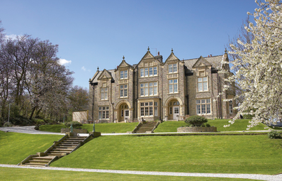
In 1892 the Webster family put the Woodlands out for lease. But in 1893, the Leeds House of Recovery purchased the mansion for a modest sum including a long term supplemental payment. The House of Recovery was an infectious disease hospital that had been operational since 1805 and was formerly located at Beckett St., Leeds. After a budget breaking stint the hospital closed and the Woodlands returned to a private residence. Today, The Woodlands is a hotel and restaurant.
It's clear from a comparison of the modern photo (above) and the 1882 sketch that the greenhouse on the left (facing) side of The Woodlands has been removed and a wing has been added in its place providing space and symmetry. (Photo from Wikipedia)
It's clear from a comparison of the modern photo (above) and the 1882 sketch that the greenhouse on the left (facing) side of The Woodlands has been removed and a wing has been added in its place providing space and symmetry. (Photo from Wikipedia)
Gelderd Rd. and Branch End:
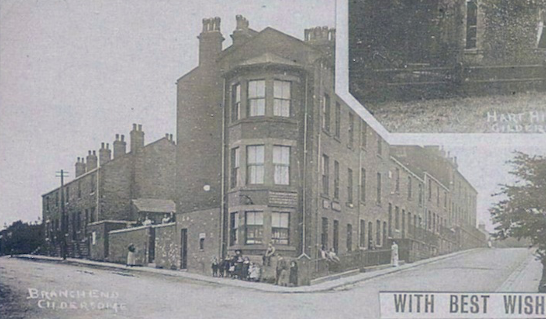
This shot was lifted from a "Scenes of Gildersome" postcard. Gelderd Road runs off to the left and Branch to the right. The row of houses to the right, on Branch avenue, was called Ebenezer Row, today five of those houses still exist. Behind the photographer is Asquith Ave. and the bridge to Morley.
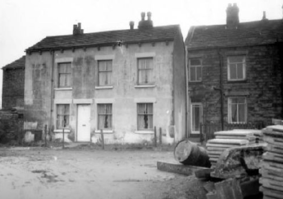
Bell Vue Terrace across from Deanhurst:
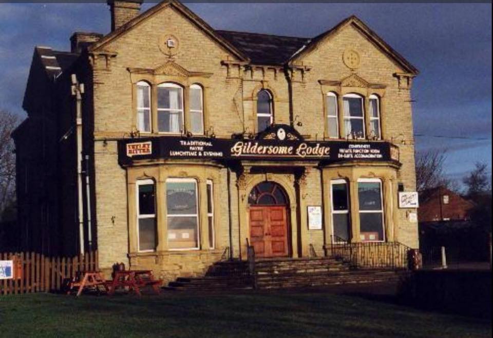
Gildersome Lodge:
In 1800, no building sat upon this property which was part of Halstead Farm, owned by Mrs. Halstead. By the 1850s, a building appears on the map which was probably the rear portion of the lodge seen above. In the 1890 O.S. map, the house appears complete, as can be seen above, and at that time it was called Deanhurst. Throughout the 1900s, the property went through various owners and uses, today it's gone.
Photo courtesy of Facebook's: Gildersome, Past Present & Future. The a photo was taken in the 1980s.
Photo courtesy of Facebook's: Gildersome, Past Present & Future. The a photo was taken in the 1980s.
Unknown location on Gelderd Rd.
If anyone knows the location of the above, email me at: History of Gildersome
Allied Mill:
|
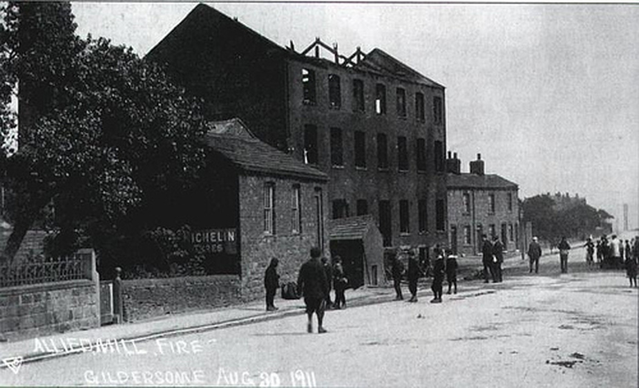
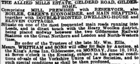
In Gildersome at the time of the 1851 census and the 1852 revised OS map, the property in which Allied Mills would later occupy, contained only Allied House (Extant) and the property at the intersection which was was called Triangle Place. In 1857, Samuel Almond built there "Almond's Mill" but the next year (1858), tragedy struck when the mill's new boiler exploded and five persons were killed, six critically injured and the mill reduced to ruin. Sometime between 1860 and by 1868 the mill was rebuilt and christened Allied mills, owned by William Ellis with Messrs. Moore, Hall and Pinder as occupiers and operators. The tenants didn't occupy the the mill for long because, in 1868, it was totally destroyed by fire. Ellis was insured and the mill was rebuilt. The mill suffered the same fate in 1911 when a destructive fire tore through the main building doing nearly £5,000 worth of damage. At the time, the executors of William Ellis owned the mill and Adna Brooke was the occupier and manufacturer. The next year, the Ellis Trustees offered the entire property, including the burnt out buildings, for sale. You can read the details of the sale by clicking on the newspaper clipping, left.
|
Old Stone Pits Road:
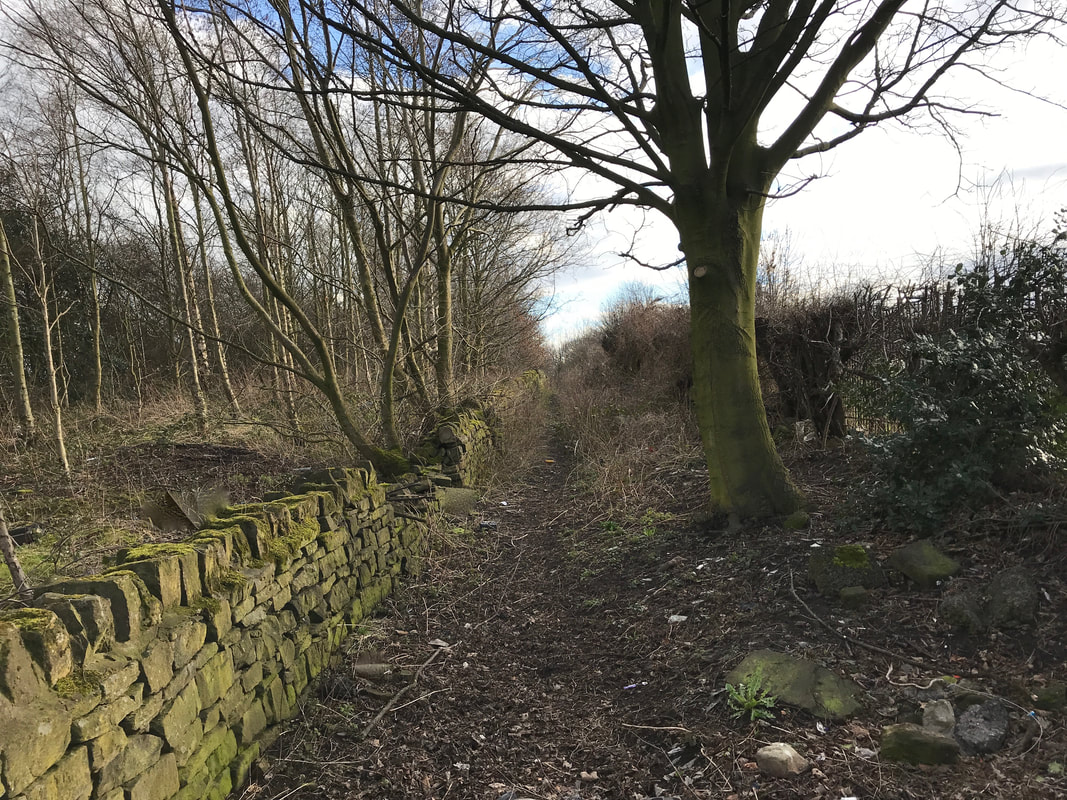
Old Stone Pitts Road, now a footpath. For centuries this was the main entrance into Gildersome for those traveling west along the Wakefield to Bradford road. Photo by Charles Soderlund
Gildersome's Windmill:
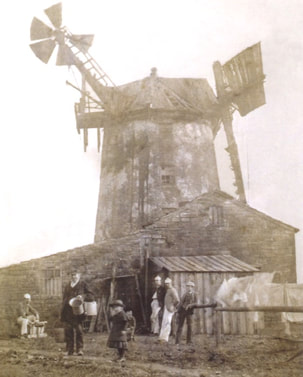
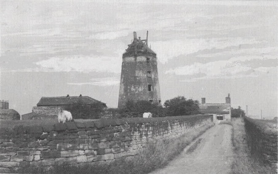
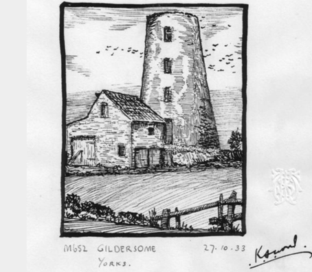
`Gildersome Windmill' is marked on 1st edn 6 O.S. on south side of field named `Windmill Close' on the tithe map. Antiquity unknown. Modern 1:2500 O.S. shows a `Mill Lane' leading away to the west and marks a ruin at approximately the former windmill site. Field visit in first instance to ascertain nature, extent and value of remains. 'The mill at Gildersome dates back to at least 1783 when it was insured by John Turton, the owner of nearby Turnton Hall. The brick structure, with a similar cap to one of the Rotherham mills, looks as though it had patent sails fitted later, with a modern fantail added as well. This photograph of about 1885 95 shows the miller, Ephraim Ellis, who probably leased the mill, with his two children and, with particularly distinctive headgear, found 'masters' from Turton Hall Academy. Ephraim died in 1918 but the mill had already fallen derelict by the time of the photograph. by 1971 the tower had been demolished and the brickwork left where it fell. Opencast coal mining eventually obliterated the site, though an old narrow footpath, Stoney Pit Lane, still flanks the field boundary.' (Gregory and Turner 2009)
The Old Windmill and a portion of Mill Farm, taken from Old Stone Pitts Lane (looking east). The lane terminating at the cottage was called Windmill Lane. It intersected with Gelderd Rd. at Parkfield and Treefield House. To the left, rising above what appears to be a haystack, is Deanhurst Mills across Gelderd Rd. The air shaft of a coal mine used to sit near the haystack.
Fatty Cake Colliery:
|
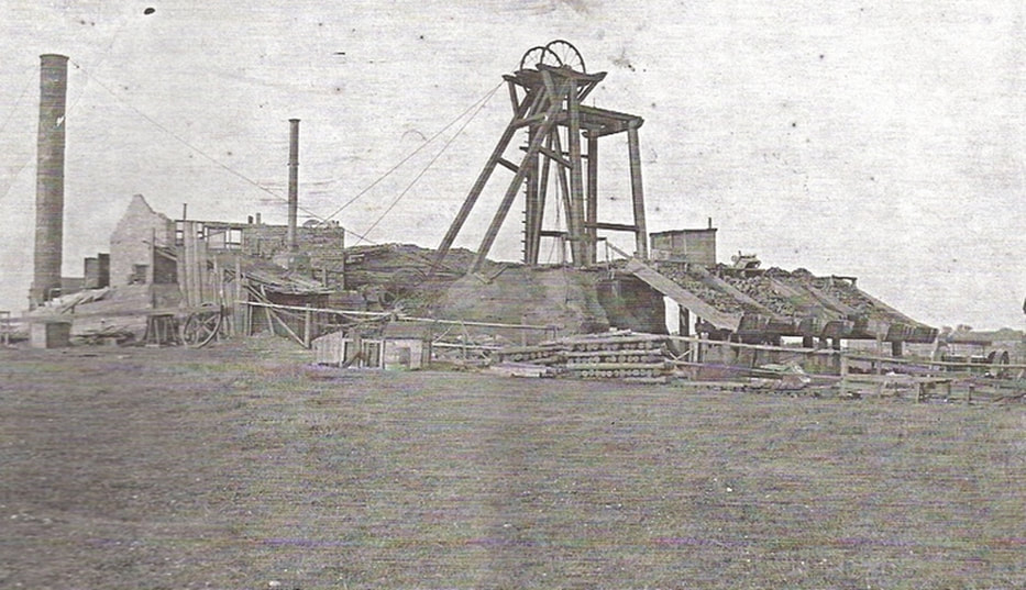
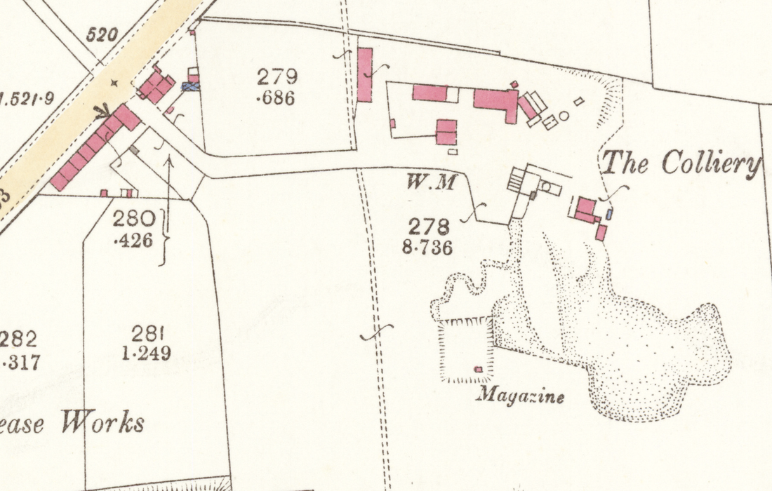
Sometimes known the Patty Cake Pit, it was probably Gildersome's most enduring of coal mines. It was located off Gelderd road, near to where Wilkies on the Treefield Industrial Estate now stands. In the 1850s it was called Newton Colliery but by 1861, I presume it had been purchased by Edward Ackroyd and Sons. At the head of the lane leading to the mine, the Ackroyd's built a row of houses called upon occasion 'Ackroyd Row' and upon others, 'Fatty Cake Row.' In 1910 the land was owned by Thomas and Matthew Stephenson but the colliery was operated by William Henry Towler. The Colliery remained active until about 1923, after that I lose track until 1938 when the O.S. map of Gildersome refers to it as "Disused."
|
Prospect Place:
|
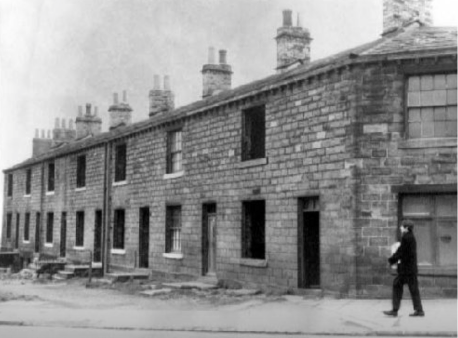
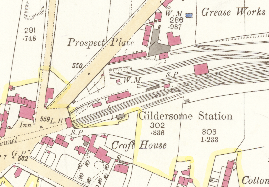
Prospect Place, built in the 1870s, was most likely put in to accommodate an ever increasing influx of labourers. In 1890, the Mawson Brothers' Grease Works occupied the space immediately behind and later it was replaced by White's Fish Meal Co. The person in the photo is walking in front of a shop that occupied the end unit adjacent to Gelderd Rd. and may be carrying items purchased from there. The photo was taken in the 1960s prior to its demolition.
|
The Intersection:
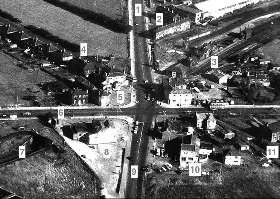
Three roads converge at the Gildersome intersection at Gelderd Road. Sadly, today much of the land around the intersection is now occupied by the roundabout and the M62.
|
7. Tunnel to or from the Station.
8. The Spread Eagle. 9. Gelderd Road to Birstall and approximate location of the Gildersome toll bar. 10. Crossways Garage. 11. Prospect House. |
Gildersome Station:
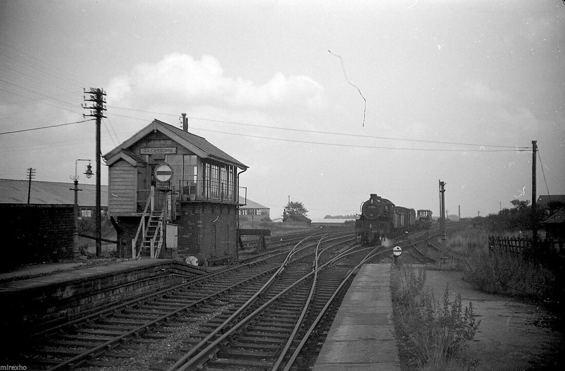
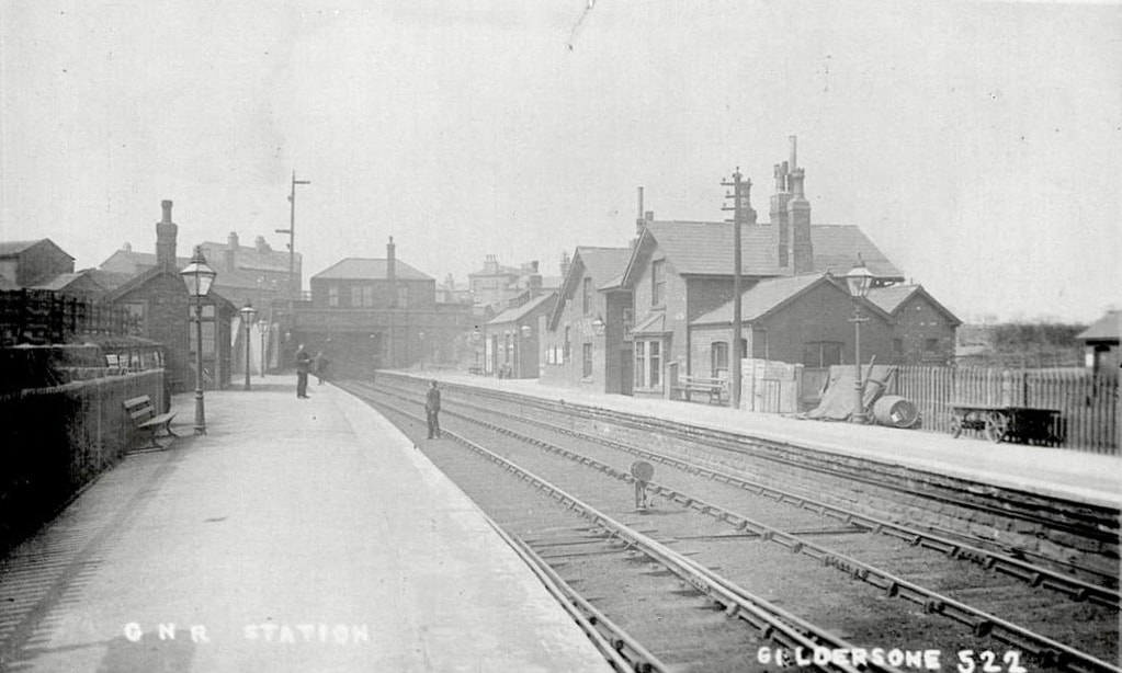
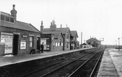
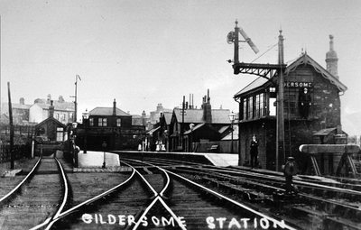
In 1856, The Leeds, Bradford and Halifax Junction Railway opened its Gildersome Branch. The branch, which was about six miles in length, began at a junction near Bradford at Quarry Gap. At that time, the branch terminated at Gildersome station but plans were already in the works to add another four mile extension to Ardsley which was completed the next year. The Great Northern Railway took over the line in 1865. Gildersome station handled passengers until 1966 and freight until 1968 when it was finally closed.
In 1856, The Leeds, Bradford and Halifax Junction Railway opened its Gildersome Branch. The branch, which was about six miles in length, began at a junction near Bradford at Quarry Gap. At that time, the branch terminated at Gildersome station but plans were already in the works to add another four mile extension to Ardsley which was completed the next year. The Great Northern Railway took over the line in 1865. Gildersome station handled passengers until 1966 and freight until 1968 when it was finally closed.
Above, a train arrives at Gildersome Station coming from the direction of Ardsley.
In this photo, it's as if the photographer in the previous picture swung his camera around 180° to take the shot. Trains traveling in this direction would be traveling toward Bradford.
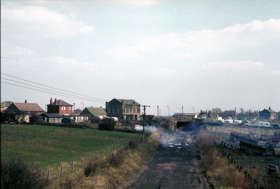
Looking at the tunnel that leads under the intersection to Gildersome Station. Taken after the removal of the track and before the construction of the roundabout.
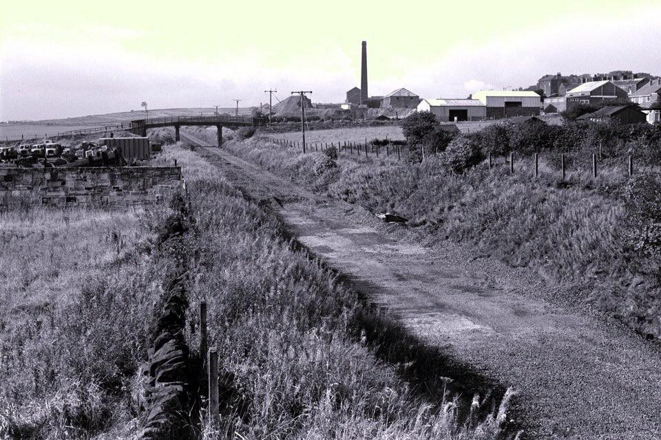
Looking toward Bradford after the removal of the track. The chimney of the Old Brickworks features prominently in the shot.
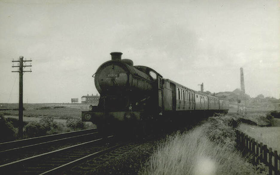
A train speeds away from Gildersome station leaving the Old Brickworks behind.
The Gildersome Bar:
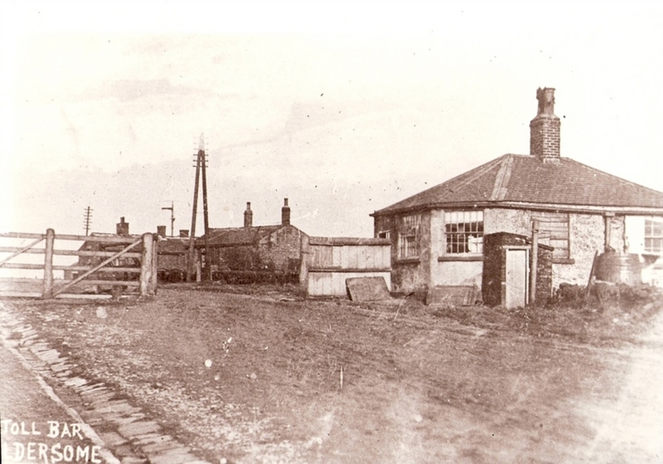
The Toll Bar and Toll Keepers house on Gelderd Rd, in a photo shot facing looking toward Gildersome. The buildings seen in the middle was a blacksmith shop. The Gildersome Bar had been located on this site since about 1826, with the founding of Gelderd Rd (The Leeds to Huddersfield Turnpike). Prior to that, and for hundreds of years in the past, the Gildersome Bar had been situated on the Bradford to Wakefield road at its intersection with Street Lane.
