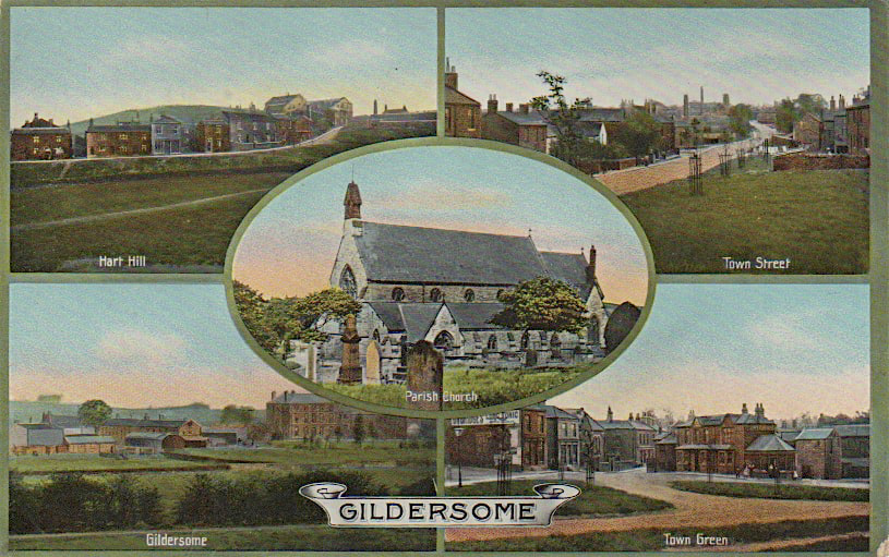
Use pull down menus above to navigate the site.
** NOTE** To see other areas of Gildersome, use the thumbnails below to open the pages.

The Green, Greenside and Finkle Lane © 17/07/19 by Charles Soderlund
with special thanks to Andrew Bedford
with special thanks to Andrew Bedford
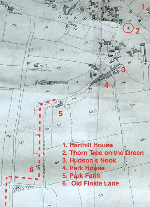 A portion of the 1800 Enclosure Map of Gildersome.
Introduction (photos below):
During the Middle Ages and right through to 1800, Gildersome's Green was a small fraction of the "Lord's waste" and was part of the demesne land of the manor. Being uncultivated, it served for public roads and for common pasture to the lord and his tenants. After the adoption of the Enclosure Act of 1773, a law enabling the privatisation of common land, Gildersome's "waste" began to shrink and one century later over 90% of the "waste" along the Bottoms, Town End, Town Street, Branch End and the Nook had been converted to private property. What remained is what we know of today as the Little Green and The Green.
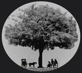
A little known fact about Gildersome' Green: According to George Wood in his "The Story of Morley," a magnificent Thorn tree sat upon the Green for untold hundreds of years and underneath were benches where townsfolk gathered to hear news and gossip while sitting in its shade. This claim is verified by the 1800 Enclosure Map of Gildersome in which can be seen a tree symbol labeled "Thorn Tree." On the map left, the symbol is located on the Green near Gelderd House, between it and the War Memorial. The tree was probably removed in order to make way for the increased traffic along Town Street around the time of the opening of Gelderd Rd. (circa 1820).
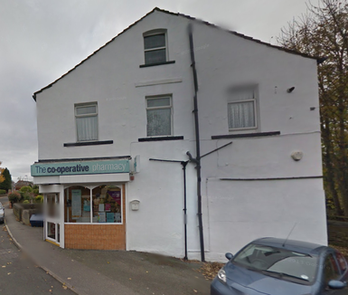
The area known as the Nooks was once a cul-de-sac off the Green that comprised the area occupied today by the Co-Op, Park House and Windsor Terrace. The name probably originated with the Quakers who had a Meeting House in its vicinity during the late 17th and early 18th centuries. The Nook didn't always connect directly to Street Lane as it does today, prior to 1800 a series of farm lanes, starting from the Nook, took several 90° turns before working its way to Street Lane, that zig-zagey farm road was known as Finkle Lane. When the new road connected the Nook directly to Street Lane (1803), it became the new Finkle Lane and old Finkle Lane was forgotten. However, its entirely possible that Vicarage Avenue and Quaker Lane are surviving remnants of the old Finkle.
During the Middle Ages and right through to 1800, Gildersome's Green was a small fraction of the "Lord's waste" and was part of the demesne land of the manor. Being uncultivated, it served for public roads and for common pasture to the lord and his tenants. After the adoption of the Enclosure Act of 1773, a law enabling the privatisation of common land, Gildersome's "waste" began to shrink and one century later over 90% of the "waste" along the Bottoms, Town End, Town Street, Branch End and the Nook had been converted to private property. What remained is what we know of today as the Little Green and The Green.
A little known fact about Gildersome' Green: According to George Wood in his "The Story of Morley," a magnificent Thorn tree sat upon the Green for untold hundreds of years and underneath were benches where townsfolk gathered to hear news and gossip while sitting in its shade. This claim is verified by the 1800 Enclosure Map of Gildersome in which can be seen a tree symbol labeled "Thorn Tree." On the map left, the symbol is located on the Green near Gelderd House, between it and the War Memorial. The tree was probably removed in order to make way for the increased traffic along Town Street around the time of the opening of Gelderd Rd. (circa 1820).
The area known as the Nooks was once a cul-de-sac off the Green that comprised the area occupied today by the Co-Op, Park House and Windsor Terrace. The name probably originated with the Quakers who had a Meeting House in its vicinity during the late 17th and early 18th centuries. The Nook didn't always connect directly to Street Lane as it does today, prior to 1800 a series of farm lanes, starting from the Nook, took several 90° turns before working its way to Street Lane, that zig-zagey farm road was known as Finkle Lane. When the new road connected the Nook directly to Street Lane (1803), it became the new Finkle Lane and old Finkle Lane was forgotten. However, its entirely possible that Vicarage Avenue and Quaker Lane are surviving remnants of the old Finkle.

The Wesleyan Church:
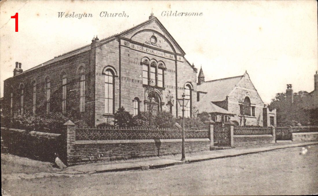
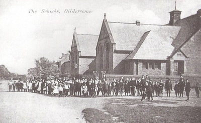
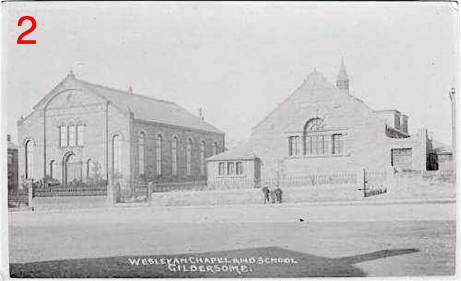
Two photos (No.s 1 &2) of the Wesleyan Methodist Church and Sunday school from different angles. Before the chapel was built in 1886, the Wesleyan's met in a chapel at the Bottoms. They used the "Old School on the Green" as their Sunday school until 1893 when the school next to the new chapel was built. Photo 2 was taken from across Town End, the shadow of the "Old Miner's Arms" can be seen in the foreground.
Both from old postcards of Gildersome
Both from old postcards of Gildersome

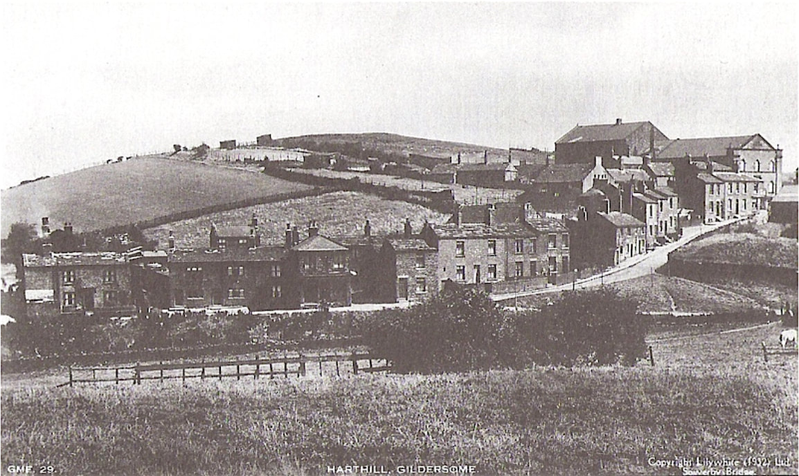
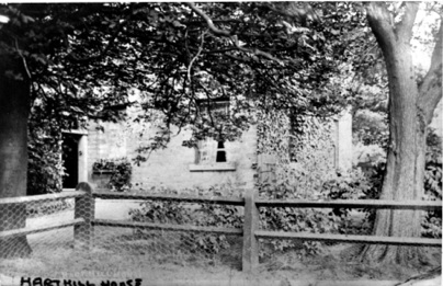
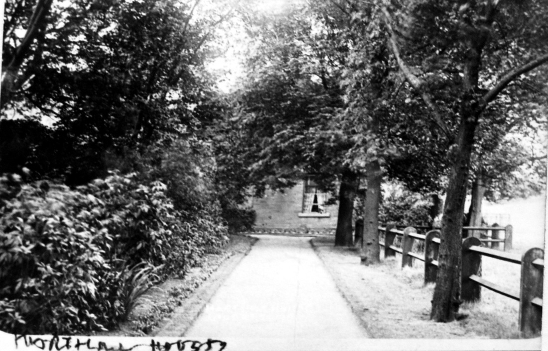
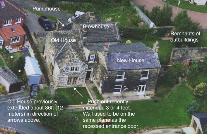
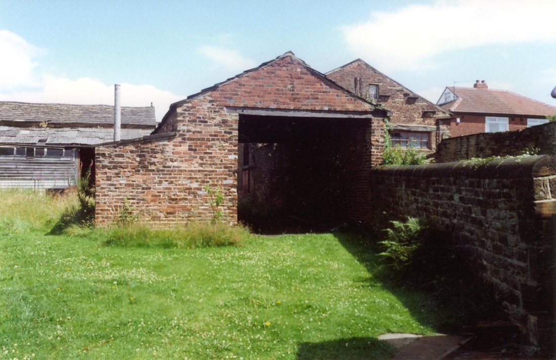
Harthill House:
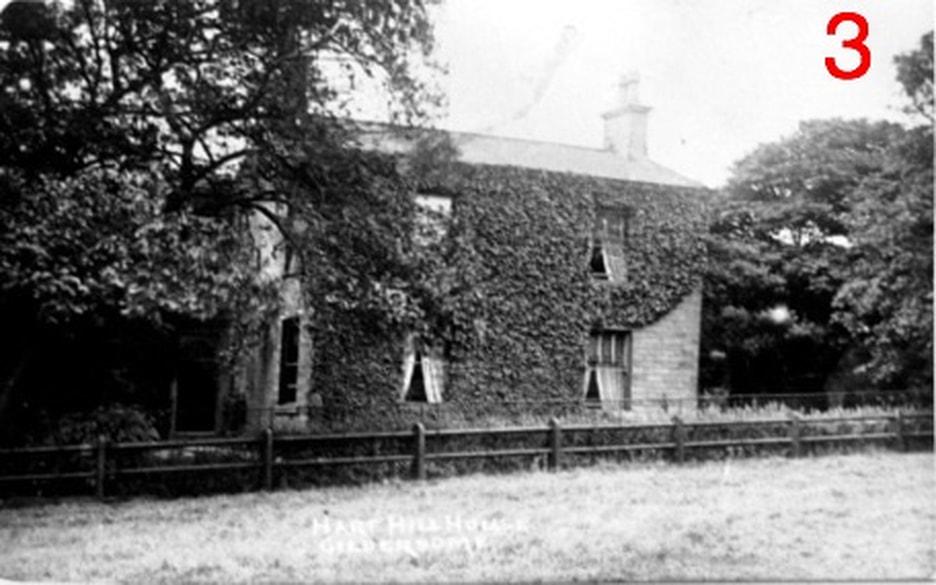
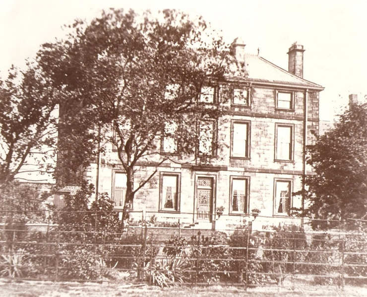
Harthill House circa 1910. The newest portion, seen above, was built around 1817. The bulk of the oldest portion (dating to the 1600s) is out of sight to the left, the rest is obscured by the trees. Behind, sat outbuildings which consisted of a brewhouse, pump room, barn, stables, malt kiln and a building that was once a blacksmiths. It's believed that during the 18th century (and perhaps the 17th), the property was the site of an inn or public house known by the various names such as the White Hart, the Peacock and the Angle (or Angel). The extant Old House and remnant walls may be the oldest surviving structures in Gildersome.
Photo Courtesy of Morley Archives
Photo Courtesy of Morley Archives
Probably a V.E. Day celebration at Cocker's Farm (Harthill House) circa the 1945.
Photo courtesy of Wendy Rushforth
Photo courtesy of Wendy Rushforth

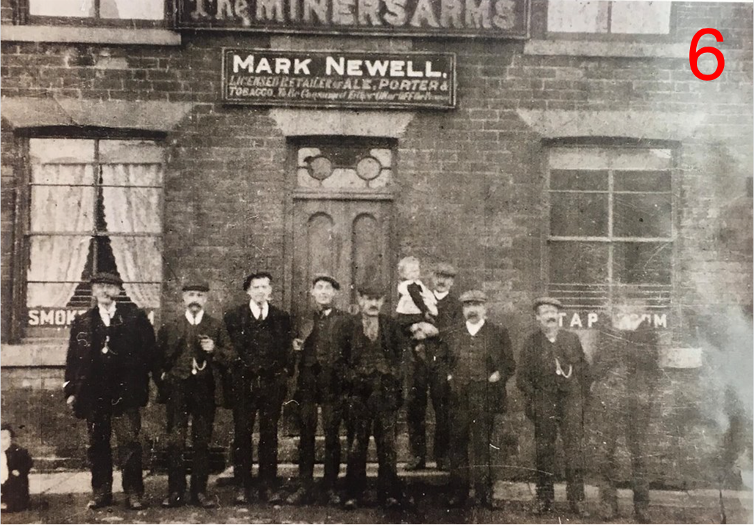
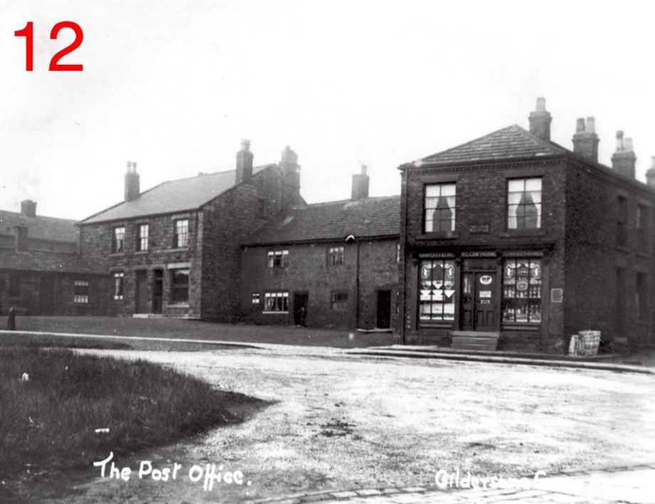
The Miner's Arms:
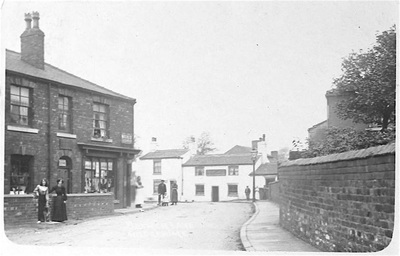
The Old Miner's Arms pub (light colour on right) dates back to before 1850. At the time of this photo, it was a hardware shop. The low dark structure to the right of the shop is the Old School on the Green. Built in 1810 by village-wide contributions to be a non-denominational Sunday school but over the years, it became a source of denominational strife. It was demolished soon after the photo was taken (1960s).
Photo Courtesy of Morley Archives
Photo Courtesy of Morley Archives
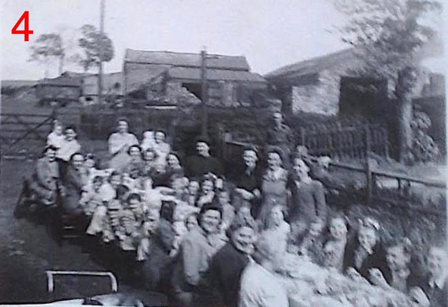
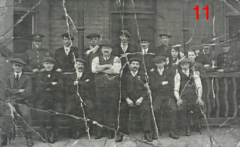
A group of men and two children pose before the old Miner's Arms.

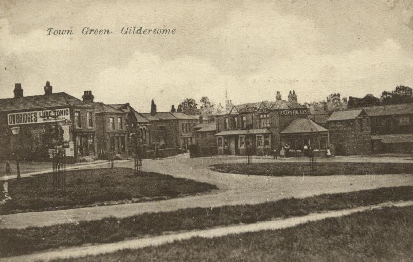
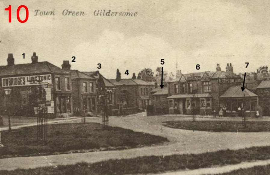
The Green:
The Green, north of Town Street. Photo of Postcard Courtesy of Joyce Smith
|
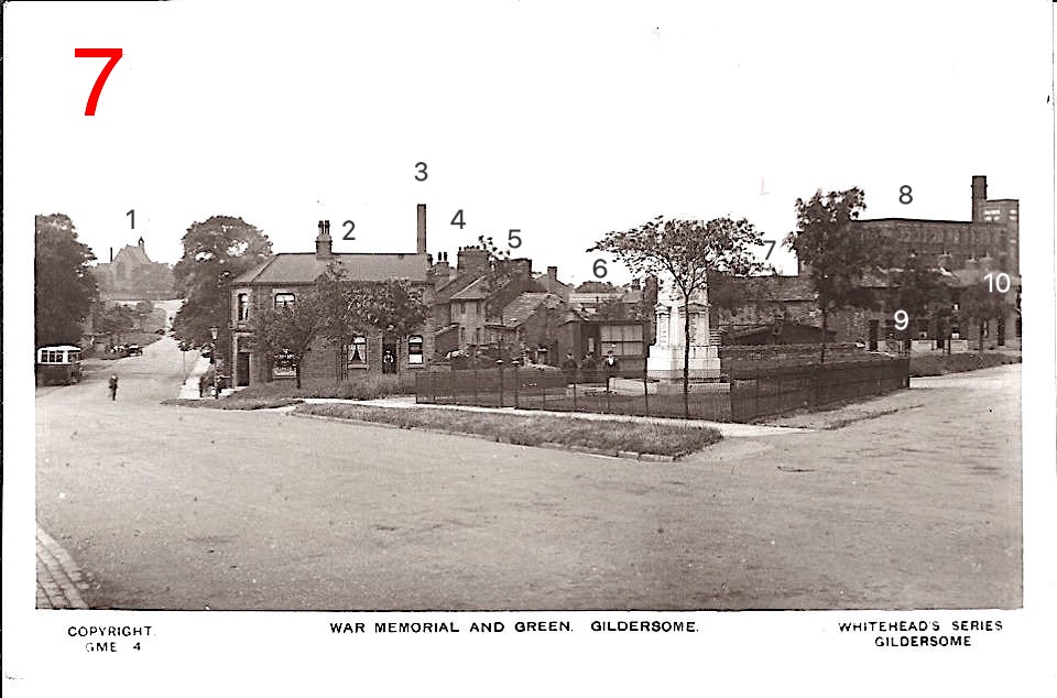
1. St. Peter's.
2. Lock-Up Shops. 3. Chimney of Old Factory. 4. Chimneys of Grove View. 5. Sharp's House, cottage attached. |
6. Old Factory Yard behind frontage.
7. Sharp's Barn. 8. Maiden Mills. 9. No's. 8 thru 12 Town End. 10. The Miner's Arms |
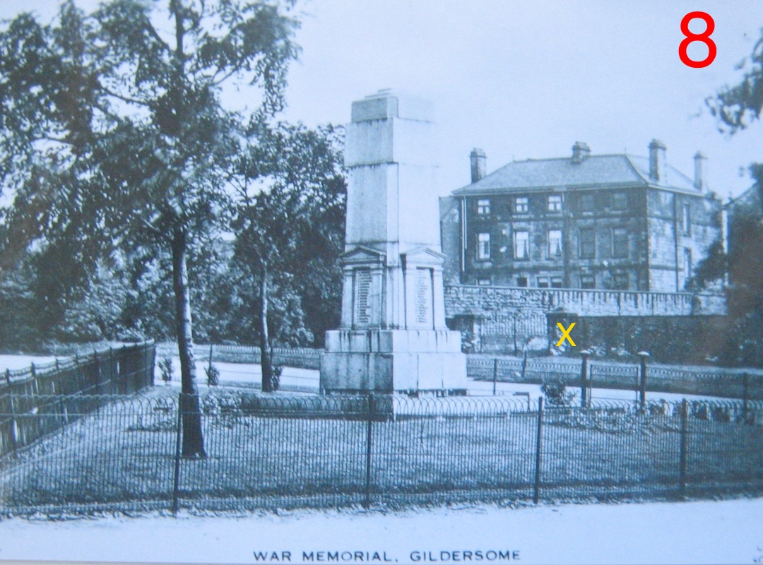
War Memorial with Turton Hall in the background. A corner of Hall Fold Row can be seen on the left and
the X marks a gated entrance to Hall Fold. From an old postcard of Gildersome.
Click here to see a bio of those WW1 names listed on the Memorial
the X marks a gated entrance to Hall Fold. From an old postcard of Gildersome.
Click here to see a bio of those WW1 names listed on the Memorial
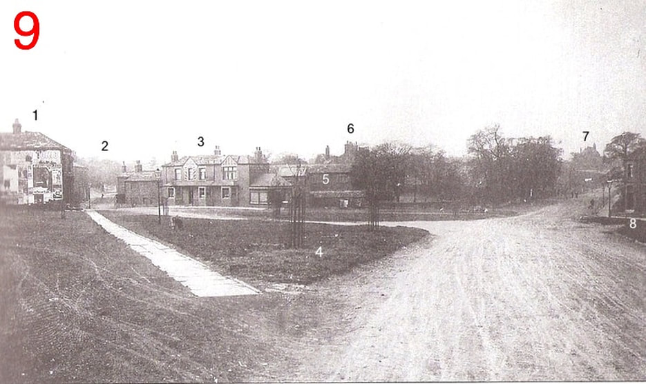
The Green, south of Town Street. From an old postcard of Gildersome
|
5. Grove Yard
6. Chimneys of Grove House 7. St Peters Church 8. Lock-up shop, Karen's Pantry today. |
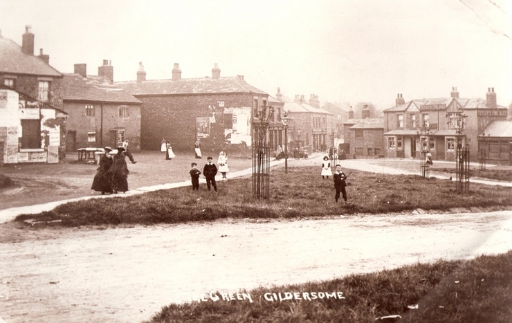
Close up of buildings around the Green at the entrance to Finkle Lane. From an old postcard of Gildersome.
|
1. Green Terrace
2. Park Terrace 3. Gildersome Primitive Methodist Church* 4. Old Co-Op Buildings |
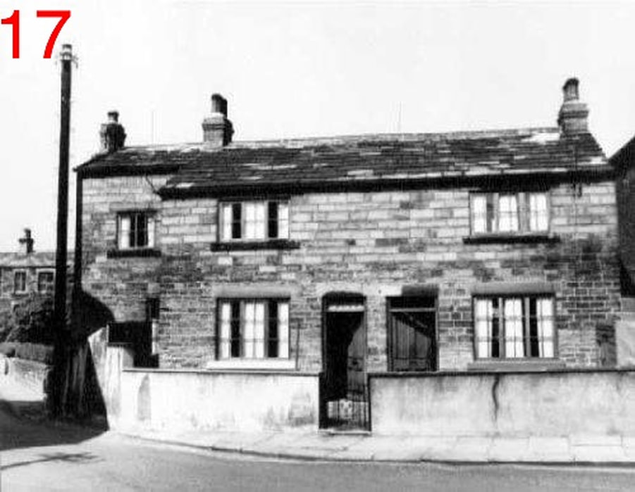
5. House at Finkle Narrows, see No. 17 below.
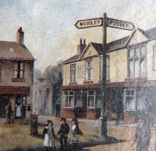
6. The Junction Inn 7. Lock-up shop. Later a barber shop. |
* The Gildersome Primitive Methodist Church has completely slipped from memory. It was built sometime around 1870, demolished after 1910 and was replaced by the Nooks and the Gildersome Working Man's Club. We, at the History of Gildersome, are currently on the lookout for documents concerning its past.
|
(Right) The "Junkie" near the Green. From an old matchbox cover.
|
|
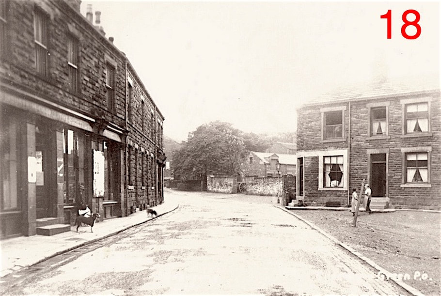
Crowd at the Junction Inn circa 1914 The formidable looking gent with his sleeves rolled up is Bob Abbott, an ex collier who looks very capable of keeping his house in order (and probably needed to be). The jacket-less young man front right is almost certainly his son, Walter who was himself landlord by 1939 and into the 1950s. It's a long shot, but can anyone out there can put any other names to the faces?

Victoria Place:
Victoria Place on the Green. The shop on the right is Green Terrace. To the left the buildings have been removed. Left of that is a very old house with the old cobbler's shop attached. More views of Green and Park Terrace below. From an old postcard of Gildersome.
|
|
|

Victoria Place. This shot was taken from Harthill. Below, Victoria Place can still be seen as well as part of the Green. Next to Park Terrace, the Primitive Methodist chapel is situated where The Nooks is located today. A rear view of the Wesleyan chapel and school fills the foreground bottom right and the line of trees on the left is the lane leading to Harthill House now Graham Walk. From an old postcard of Gildersome.

Dwelling House:
This house appears on the 1852 Ordnance Map of Gildersome an now abuts the restaurant that was once the Junction Inn.

Co-Operative Store at the Nook:
The Old Cooperative Store and buildings (left) circa 1910. The Co-Op area had been called Hudson's Nook since the mid 18th century, there the Hudson Family (3 generation owners of Park House) operated a drysaltery and a cloth hall. Hudson's Nook was also a mercantile centre for Gildersome where, for almost two centuries, were located grocers, drapers, cobblers etc. The car park of the new Co-Op Market occupies the spot today. On the right is Windsor Terrace and behind that was Dixon's Fold, now called the Grove. One can just make out the Lion Store on the extreme left of the road bend. From an old postcard of Gildersome.

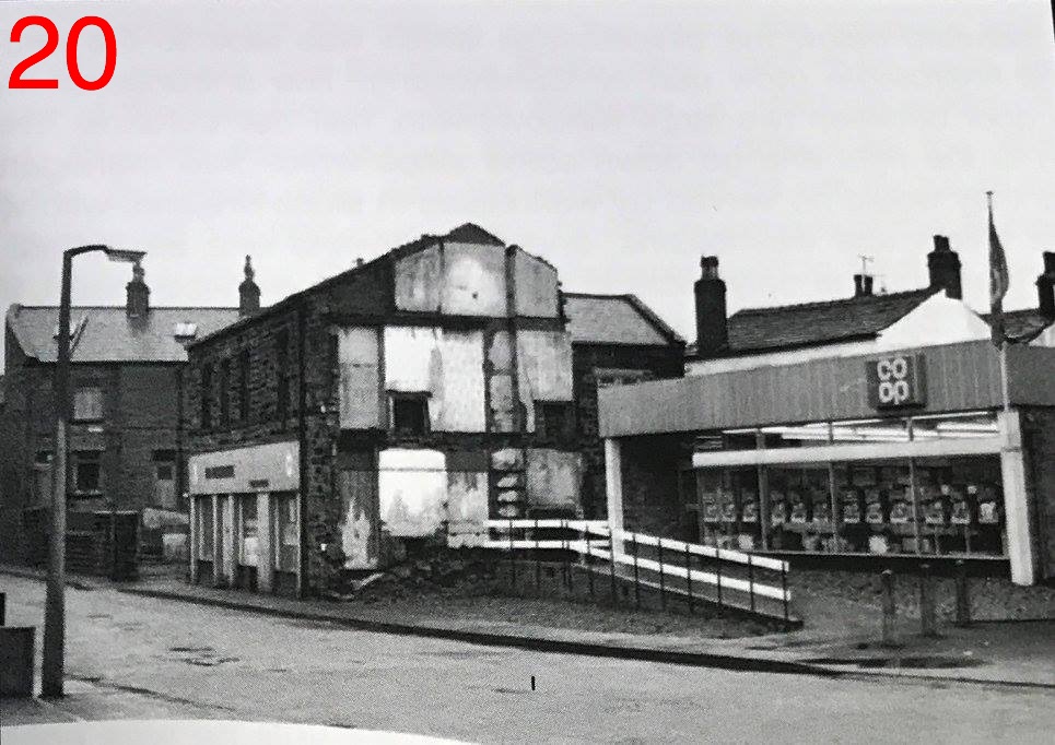
The Morley Industrial Co-operative Flour and provisional Society, Limited (established in 1866), better know as simply the Co-Op, opened its first branch store in Gildersome Bottoms in 1874. But in 1876, they contracted with George Troughton Bedford, who owned the Nook, to purchase the two ancient 17th century buildings that fronted Finkle Lane. Since the Co-operative wanted to pull down the two old buildings and replace them with modern structures suitable for the trade, Gildersome's Local Board approved the project provided that the Co-Op release to the town a portion of their property six foot in width and spanning their entire frontage with Finkle Ln. Though Finkle was widened, the town never seemed able to expand the constriction between the Green and the Nook which still exists. In 1971 the old Co-Op buildings were demolished and replaced by today's carpark and grocery.

Lion Store:
|
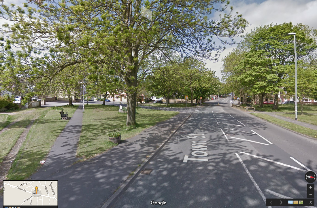
This building, that once contained the Lion Store, is clearly apparent on the 1800 Enclosure Map of Gildersome. In the early 18th century it may have been the home of Reverend Nathaniel Booth and his Booth realtions for a century. During the early 19th century it was occupied by a grocer and has been a shop since. The 1910 photo is from an old postcard of Gildersome, the 2017photo is from Google Street View
|
|

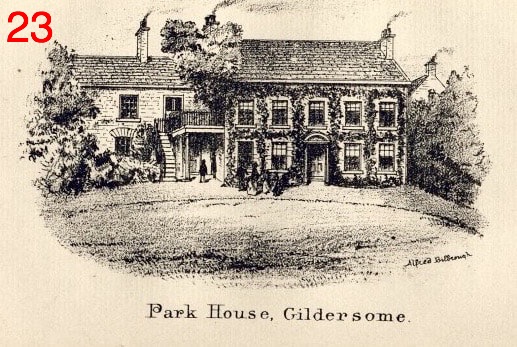
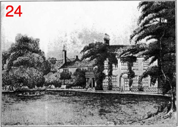
Park House:
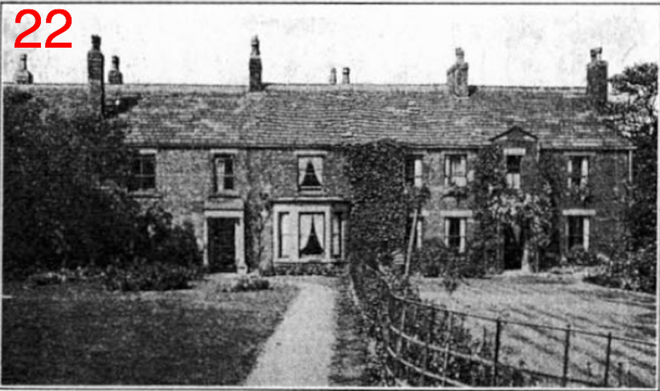
Park House: The two pictures below were made by Alfred Bilbrough (1819-1891) of Harthill House and portray Park House from the Park side (the opposite side from Finkle Lane) which, for almost two centuries, had been its main entrance. The oldest portion, to the right in all pictures, was most likely built by the first William Hudson in the 1730s. Number 23 is a pen and ink drawing and shows the roof of a cottage in the Nook (behind trees to the right), called "Hudson's Nook" in those days. Picture #24 is a larger oil painting that once hung in Park House, it reveals the island with the moat (left) that resided in the lawn called "the Park." The larger photo above was shot in the 1930s of the same side as those below. By then, Park House had been expanded and subdivided. The Hudson family resided at Park House for three generations, and around 1829, they passed it on to the Bilbrough family. In 1867, it was sold to the Holliday Family.
|
|

Belmont:
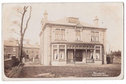
Belmont was built between 1890 and 1903 by Cyrus Holiday of Park House most likely for his son William Henry Holliday who occupied the house in 1930. Later in the '60s it became a surgery for a Dr. Wilson. The photo above, circa 1910, was shot from the rear of Belmont, Glover Row can be seen across Finkle on the left. Old postcard courtesy of Joyce Smith

Glover Row:
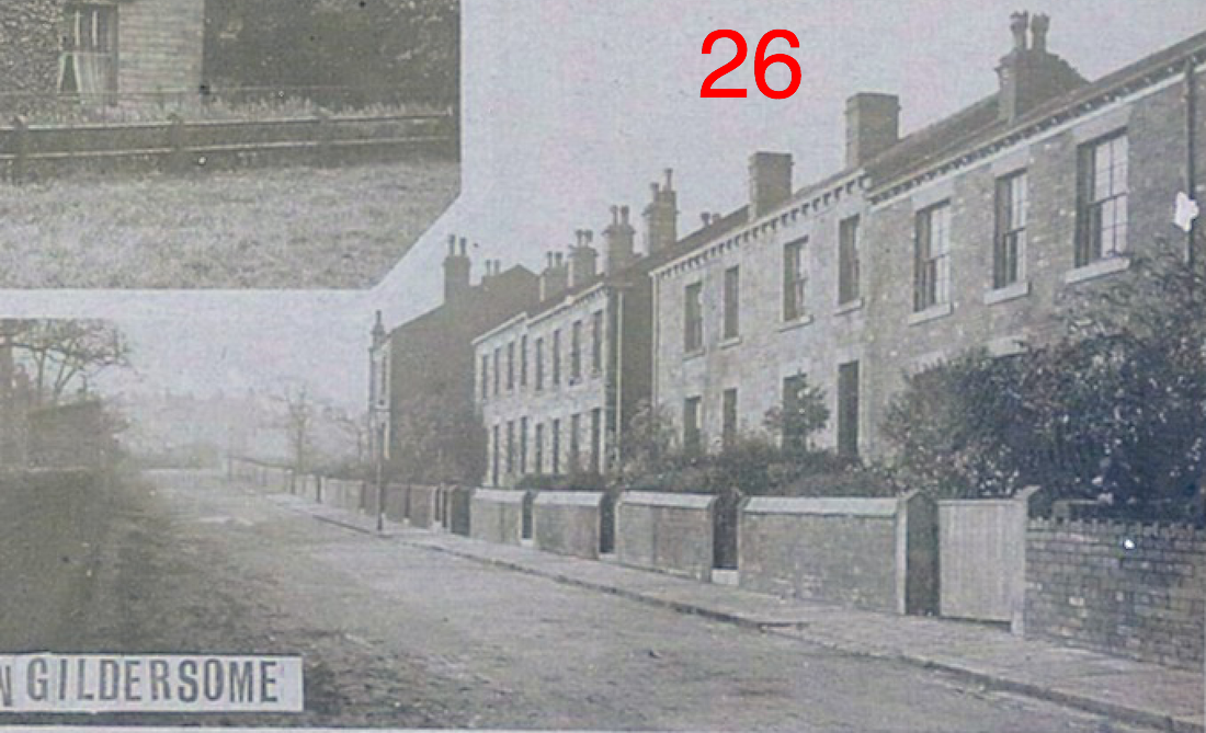
Looking toward the top of Finkle, Glover Row is on the right, Belmont is to the left out of the shot. This row was probably built in the 1870s or 1880s. The photo is a blow-up of the lower right hand corner of an old postcard of Gildersome.

Finkle Farm:
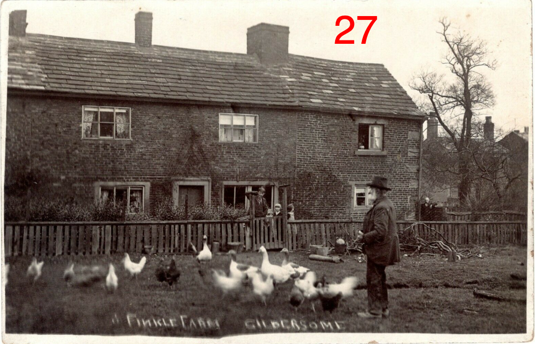
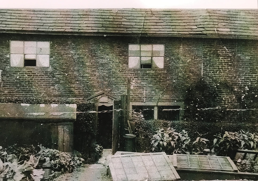
Finkle Farm (photo top circa 1915 and below circa 1930), was located approximately at the entrance of Vicarage Avenue. It appears in a 1739 map of Gildersome but its origin probably goes back to the 17th century or earlier. It got its name from the surrounding by fields called "Finkle Close"and "Finkle Croft." The Booth family owned this property for over 200 years.